Fresh Batch #63 (Free For Everyone): Holy Sailors' Locations
A Companion Piece to Book V of Spirit Whirled
The following are visuals that I couldn’t include in the The Holy Sailors for the sake of printing costs. All images are protected under Fair Use to give the reader insight on the subject matter, for educational purposes only. If you’re of European descent, especially that of Italian, British, or Scandinavian, this will shine light on your history like nothing else. The book that gives insight on this cultural diffusion is available in all formats, from ebooks to paperbacks, hardcovers, and audiobooks. Click the image to begin the journey.
Almendres Cromlech
According to Wiki, the construction of the Almendres Cromlech structures dates back to the 6th millennium BC. They were rediscovered in 1966 by Henrique Leonor Pina, who was carrying out field work relating to the country's geological charts.
The excavation of the site unearthed a series of both megalithic and neolithic construction phases; Almendres I 6000 BC (Early Neolithic), Almendres II 5000 BC (Middle Neolithic), and Almendres III 4000 BC (Late Neolithic). The relative chronology of the cromlech and menhirs is extremely complex and covers a period from the Neolithic to Chalcolithic. It is believed that the monument either had a religious/ceremonial purpose or functioned as a primitive astronomical observatory.

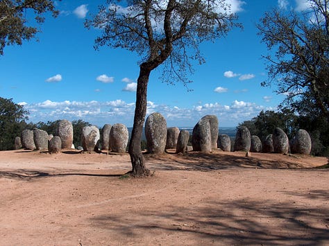
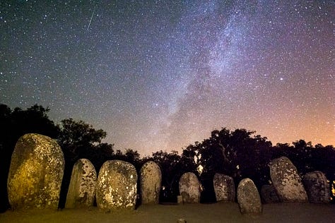

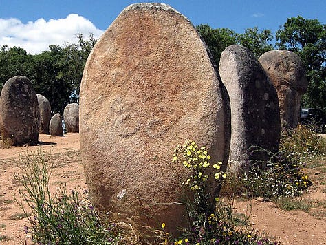

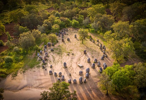
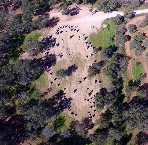
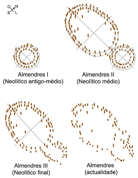
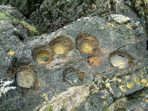
There is ancient, faded remains of what looks like “cup & ring art” that’s found in Britain and in Etruria, however I suspect they aren’t art. At least with come of them they serve as the foundation from either a structure or tools.
Angulimala Stupa
According to IndiaNetzone, “Angulimala Stupa is located in the ancient city of Shravasti in Uttar Pradesh. The stupa was excavated with the other ruins of Shravasti during 1863. Among the ruins of the Angulimala stupa, only the walls, a plinth and raised platform with a flight of stairs can be seen on the spot. Angulimala Stupa represents the immense influence of Gautama Buddha, which was indispensable for the development of civilization. The stupa is one of the major monuments of Shravasti.”
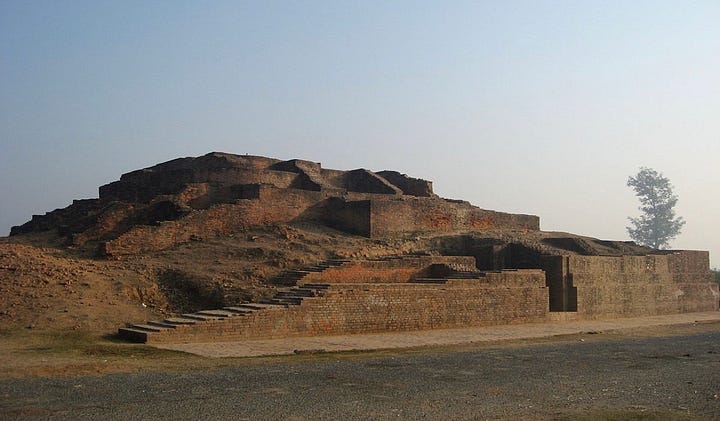

Aṅgulimāla (Pāli language; lit. 'finger necklace') is an important figure in Buddhism, particularly within the Theravāda tradition. Depicted as a ruthless brigand who completely transforms after a conversion to Buddhism, he is seen as the example par excellence of the redemptive power of the Buddha's teaching and the Buddha's skill as a teacher. Aṅgulimāla is seen by Buddhists as the "patron saint" of childbirth and is associated with fertility in South and Southeast Asia.

The Piprahwa (Northern India)
According to Wiki, Piprahwa is best known for its archaeological site and excavations that suggest that it may have been the burial place of the portion of the Buddha's ashes that were given to his own Shakya clan. A large stupa and the ruins of several monasteries as well as a museum are located within the site. Ancient residential complexes and shrines were uncovered at the adjacent mound of Ganwaria.
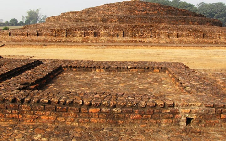
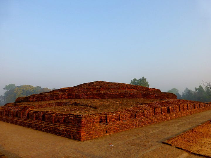
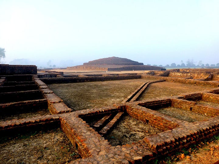
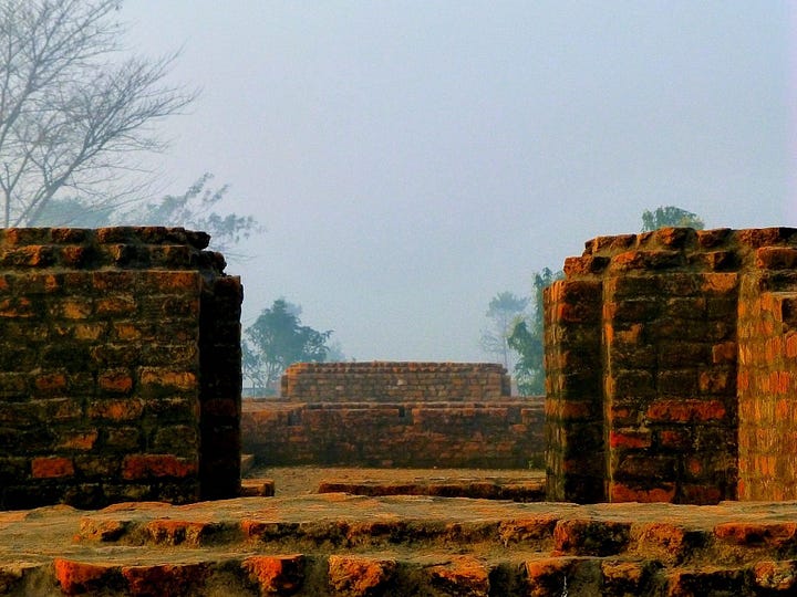
A buried stupa was discovered by William Claxton Peppe, a British colonial engineer and landowner of an estate at Piprahwa in January 1898. Following the severe famine that decimated Northern India in 1897, Peppe led a team in excavating a large earthen mound on his land. Having cleared away scrub and jungle, they set to work building a deep trench through the mound. After digging through 18 feet of solid brickwork, they came to a large stone coffer which contained five small vases containing bone fragments, ashes, and jewels. On one of the vases was a Brahmi script which was translated by Georg Bühler, a leading European epigraphist of the time, to mean:
Sukiti-bhatinaṃ sabhaginikanam sa-puta-dalanam iyaṃ salila-nidhane Budhasa bhagavate sakiyanam
"This relic-shrine of divine Buddha (is the donation) of the Sakya-Sukiti brothers, associated with their sisters, sons, and wives,
This inscription implied that the bone fragments were part of the remains of Gautama Buddha, the founder of Buddhism. Throughout the following decade or so, epigraphists debated the precise meaning of the inscription. Vincent Smith, William Hoey, Thomas Rhys Davids, and Emile Senart all translated the inscription to confirm that these were relics of the Buddha.
I, of course, remain suspicious of this on account of it not being discovered till the end of the 19th century, which, to clarify my position, doesn’t mean it’s inauthentic, but the inscriptions are what I am skeptical of, given the likelihood that Buddha was not a historical figure.
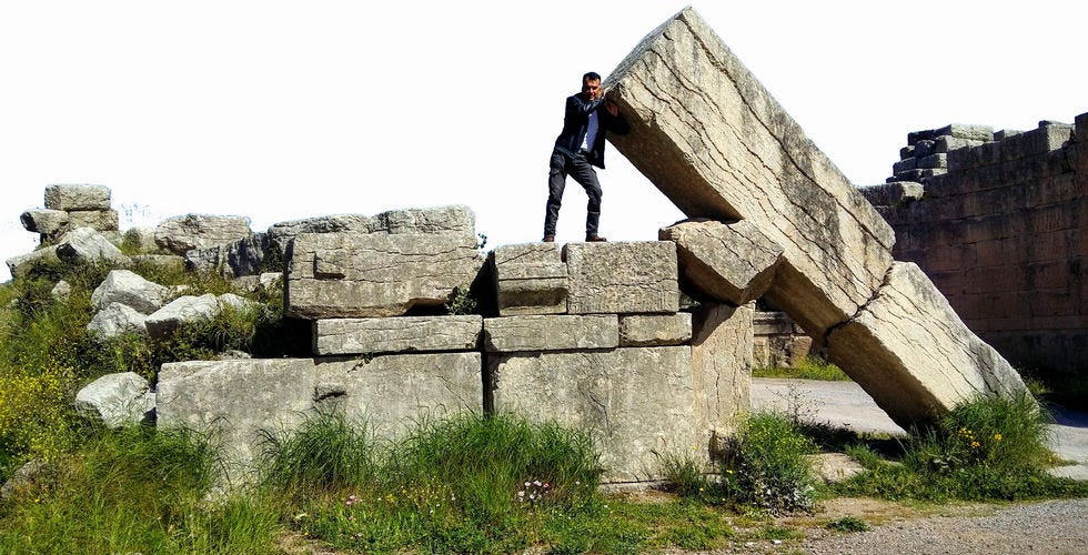
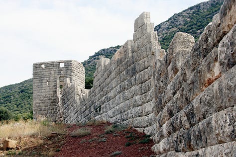
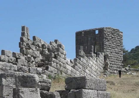
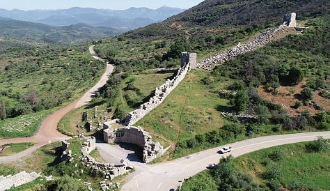
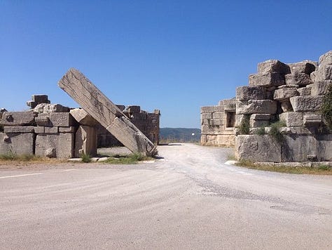
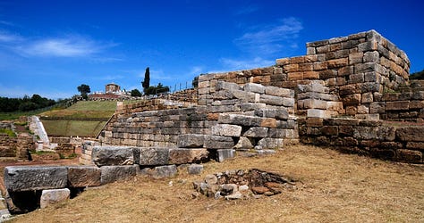
Arcadian Gate
According to Greece Private Tours, “The town was built by the combined Theban and Argive armies and the exiled Messenians (Messenians trace themselves to the Mecenia) who had been invited to return and found a state which should be independent of Spartan rule. The site was chosen by Epaminondas and lay on the western slope of the mountain which dominates the Messenian plain and culminates in the two peaks of Ithome and Eua.
“The former of these (740 m or 2,630 ft) served as the acropolis, and was included within the same system of fortifications as the lower city. But what chiefly excited his wonder was the strength of its fortifications, which excelled all those of the Greek world.”




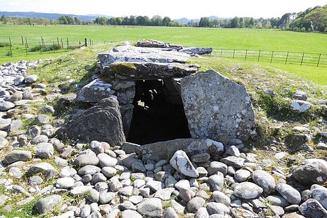
Bryn Celli Ddu (Anglesey, Wales)
According to Wiki, Bryn Celli Ddu Welsh pronunciation: [brʌn keːɬi ðɨː] is a prehistoric site on the Welsh island of Anglesey located near Llanddaniel Fab. Its name means 'the mound in the dark grove'. It was archaeologically excavated between 1928 and 1929. Visitors can get inside the mound through a stone passage to the burial chamber, and it is the centrepiece of a major Neolithic Scheduled Monument in the care of Cadw. The presence of a mysterious pillar within the burial chamber, the reproduction of the 'Pattern Stone', carved with sinuous serpentine designs, and the fact that the site was once a henge with a stone circle, and may have been used to plot the date of the summer solstice have all attracted much interest.
The earliest identified remains at the site are a row of five postholes previously thought to have been contemporary with the tomb. Radiocarbon dating of pine charcoal from two of the pits, carried out in 2006, showed these to date from around 4000 BC, putting them at the end of the Mesolithic, 1,000 years before the next phase of use. Their purpose, however, is unknown.
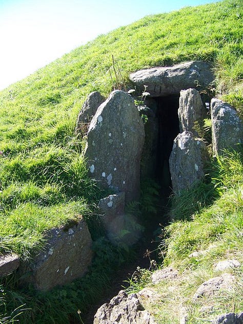
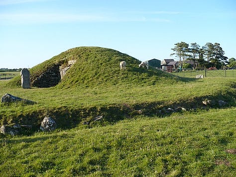

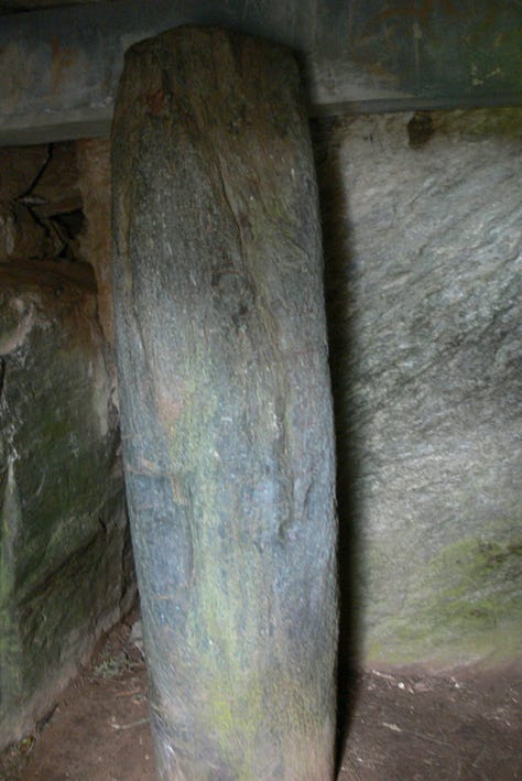
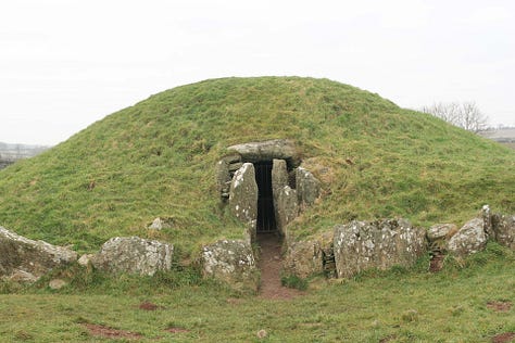

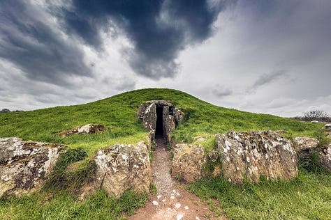

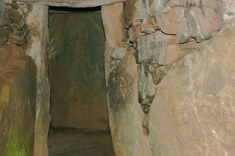
This site is almost identical to locations in Etruria, a clear sign of diffusion, something that can only be explained by a maritime empire having the capability to get there, i.e., the Etrusco-Phoenicians, hence the affinity to the Celtic and the use of their alphabet in Britain.
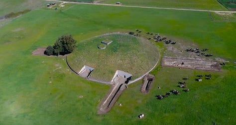
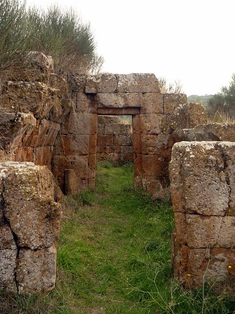
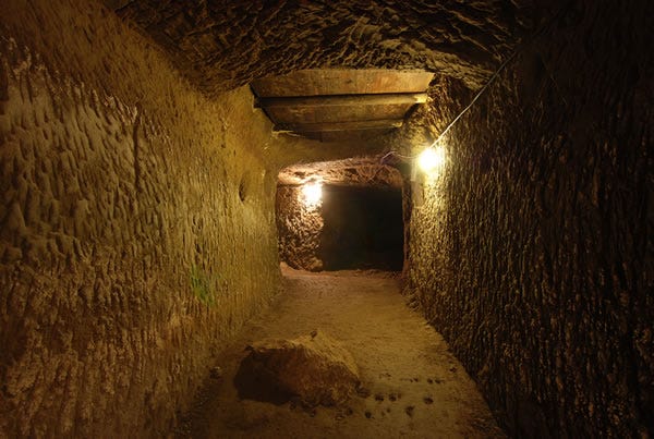
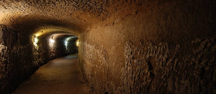
Tumulo della Cuccumella (Italy)
This is a unique site that has the tomb comparable to what is found in Britain and the masonry and lintels found in the Americas, paired with the precision found in Egypt.

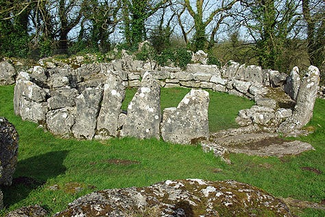
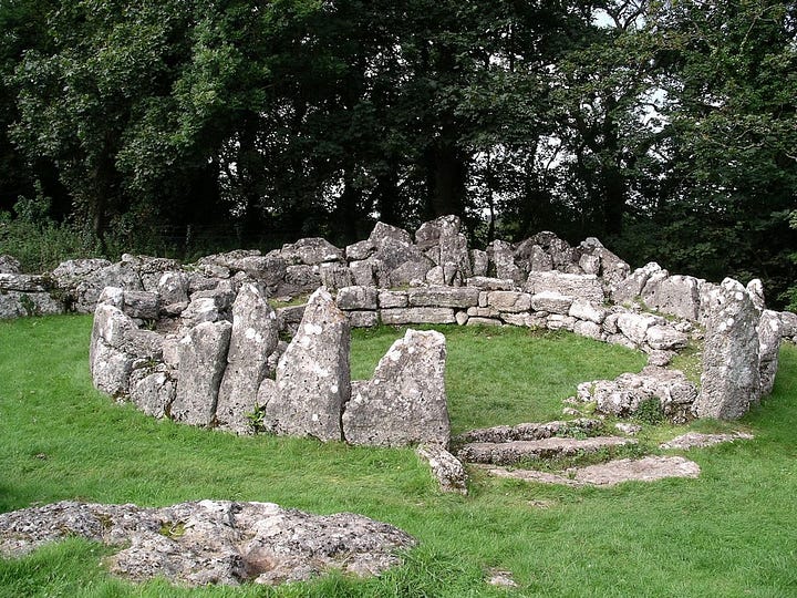
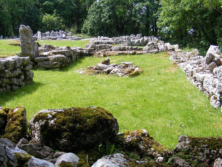
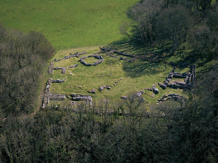
Din Lligwy (Anglesey, Wales)
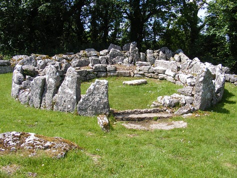
According to Wiki, Din Lligwy (or Din Llugwy) hut circle is an ancient village site near the east coast of Anglesey, close to the village of Moelfre, North Wales.
Excavations in 1905–1907 produced hundreds of Roman-period pot sherds of the 3rd and 4th centuries CE, many repaired with iron clamps. Animal bones were found too, some made into tools and one into a musical instrument. The most important economic activity, however, appears to have been iron working, smithing and perhaps smelting.


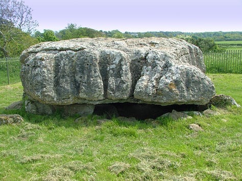
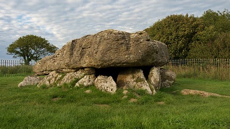

Cairns
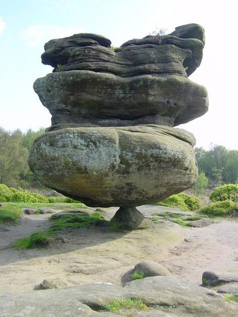
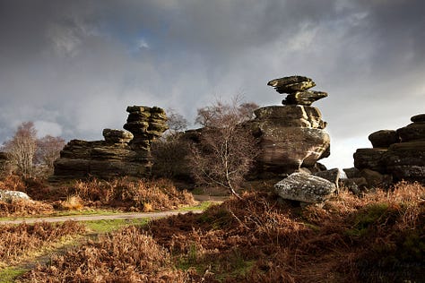
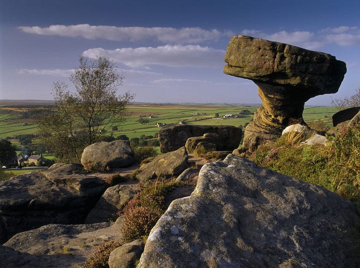
Brimham Rocks, Yorkshire (England)
According to Wiki, the site is known for its water- and weather-eroded rocks, which were formed over 325 million years ago and have assumed fantastic shapes. In the 18th and 19th centuries, antiquarians such as Hayman Rooke wondered whether they could have been at least partly carved by druids, an idea that ran concurrently with the popularity of James Macpherson's Fragments of Ancient Poetry of 1760, and a developing interest in New-Druidism.
If these are natural, caused by water, it basically destroys all the claims about Doggerland because that requires much lower water levels circa 6500 BC, and these rocks would require the opposite conditions.
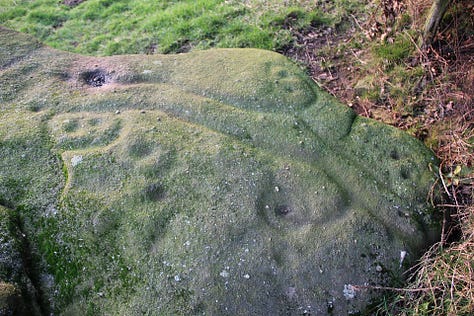
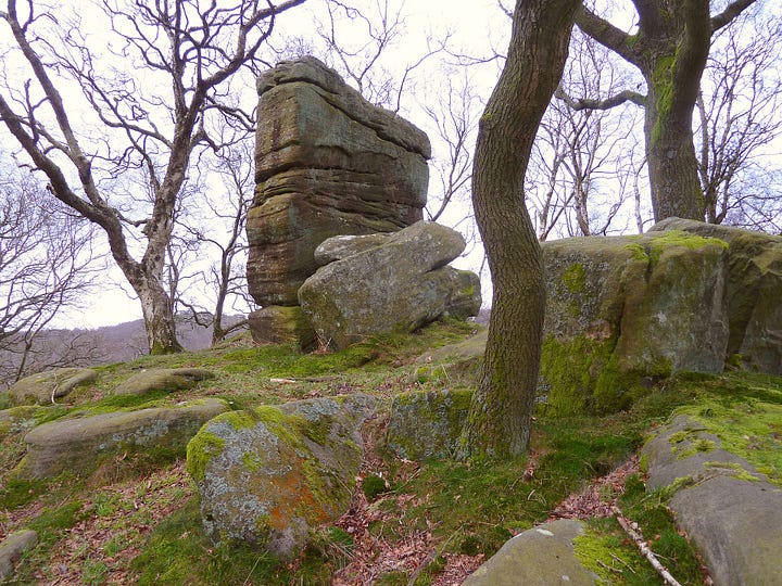
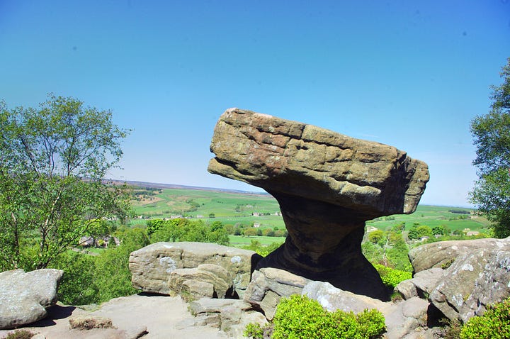
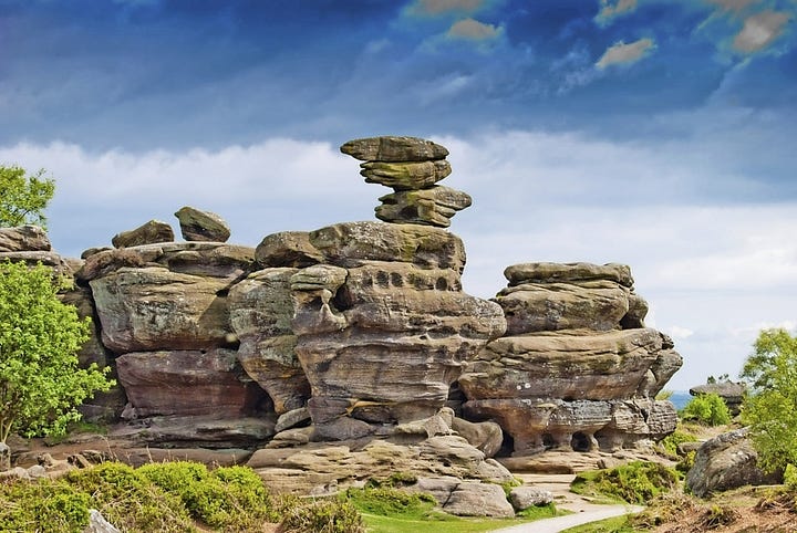
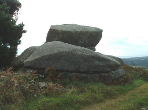
Cheesewring, Cornwall
According to Wiki, The Cheesewring (Cornish: Keuswask) is a granite tor in Cornwall, United Kingdom, situated on the eastern flank of Bodmin Moor on Stowe's Hill in the parish of Linkinhorne approximately one mile northwest of the village of Minions and four miles (6 km) north of Liskeard. It is a natural geological formation, a rock outcrop of granite slabs formed by weathering. The name derives from the resemblance of the piled slabs to a "cheesewring", a press-like device that was once used to make cheese.
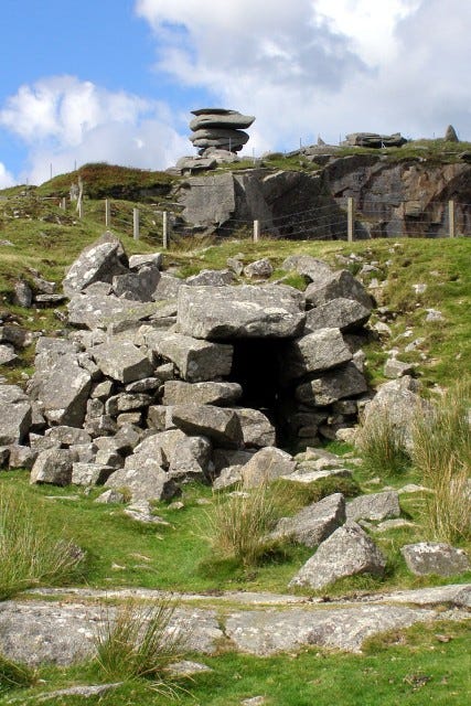
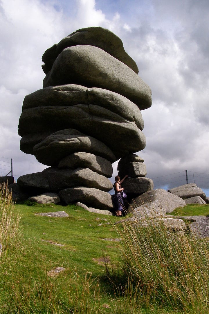
This site is significant because Cornwall was peopled by Phoenicians. However, while I agree some of these are stones are stacked, some of them look to be the remains of geological phenomena, similar to what we see in Montana (The Sage Wall and the erroneously labeled dolmens), as well as in places like Germany.
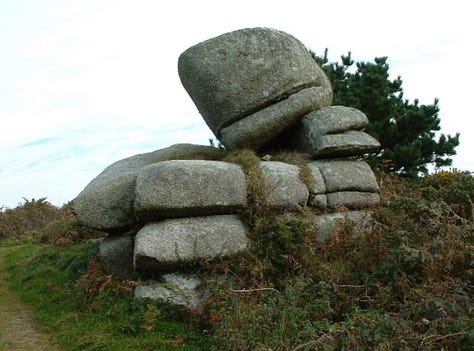
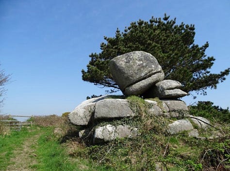
Logan Rock, Cornwall
While it’s hard to get a good picture, it appears to be balanced, but again, we’ve seen this in nature before, rare as it may be.
According to Wiki, The original Cornish language name for the rock, recorded in 1870 as Men Amber, is Men Omborth, meaning balanced stone. The word "logan" (properly pronounced "logg-un") is probably derived from the word "log", which in an English dialect means "to rock". In fact, in some parts of the UK, rocking stones or logan stones are called logging stones. Bray, writing in 1832, notes the expression 'to log the child's cradle' in relation to logan stone as an example of ancient British dialect recorded on Dartmoor in Devon.
The Cornish word Leghen means "a thin flat stone", whilst its root word, Legh, can also mean "rickets", a disease caused by deficiency of vitamin D and Calcium which can lead to bone deformity.

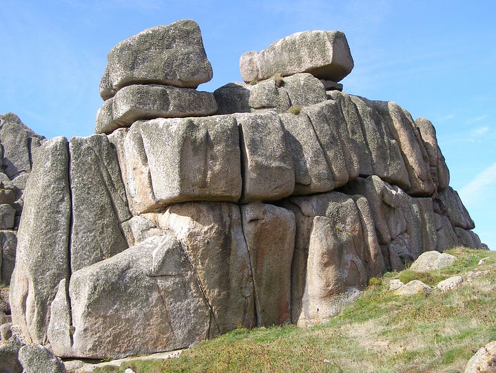


Scilly Islands
Peninnis Head (Cornish: Penn Enys, meaning Island Head) is the southernmost point of St Mary's, Isles of Scilly.
Also in Corwall is Pulpit Rock and the Scilly Islands.
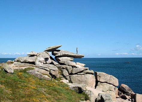
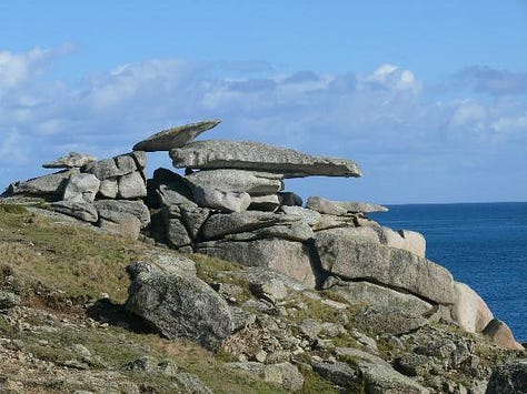


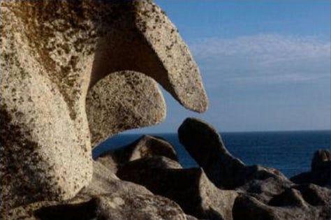

Historically, the Isles of Scilly were known in Latin as Insulae Sillinae, Silina or Siluruni, corresponding to Greek forms Σίλυρες and Σύρινες. In the Late Middle Ages they were known to European navigators as Sorlingas (Spanish, Portuguese) or Sorlingues (French). In the Cornish language, the Isles of Scilly is Syllan. The etymology is unknown. Some authors suggest the Latin Sillinae is derived or related to solis insulae, "the Isles of the Sun".
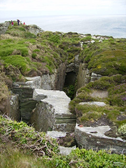
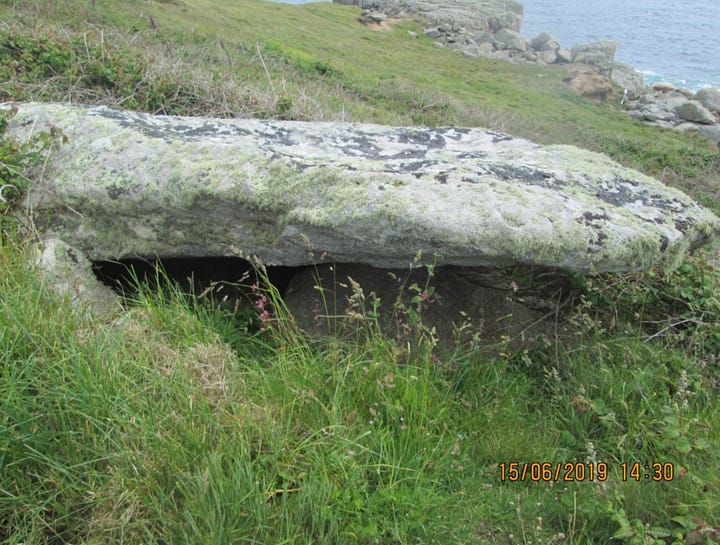
Iona Abbey (Scotland)
According to Wiki, in 563, Columba came to Iona from Ireland with twelve companions, and founded a monastery. It developed as an influential centre for the spread of Christianity among the Picts and Scots.
At this time the name of the island and so the abbey was "Hy" or "Hii"; "Iona" only seems to date from the 14th century, as a mis-transcription of a Latinized "Ioua" for "Hy".
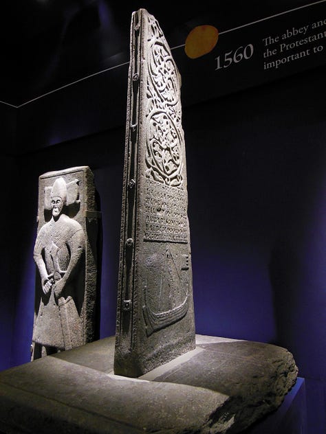
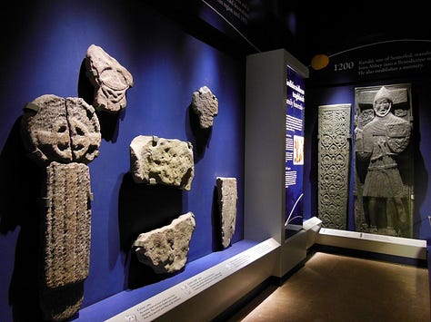

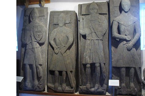

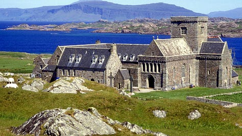
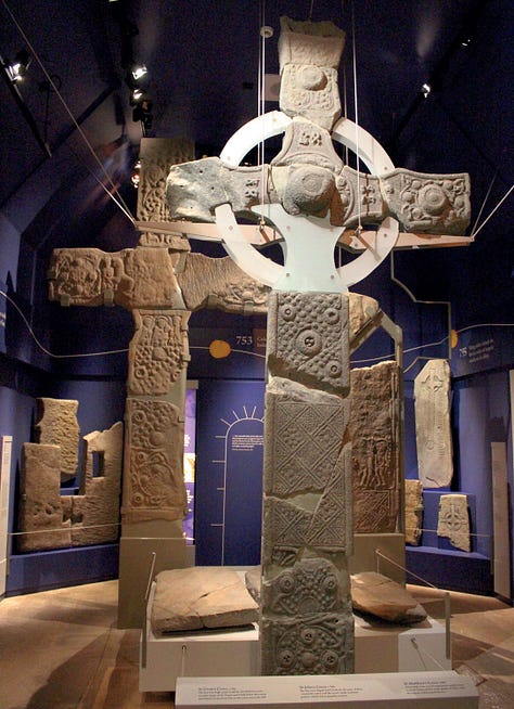
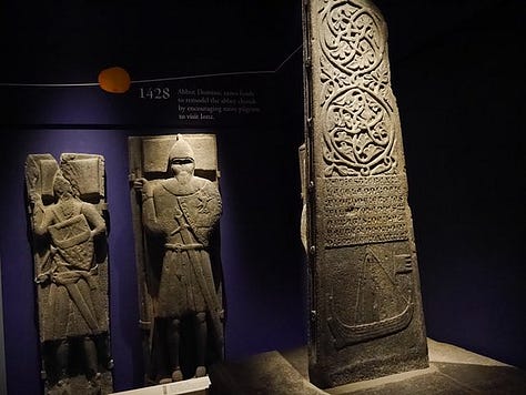
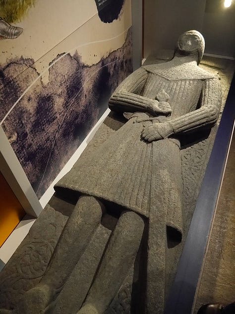
Isle of Arran (Scotland)
According to Wiki, Arran has a particular concentration of early Neolithic Clyde Cairns, a form of Gallery grave. The typical style of these is a rectangular or trapezoidal stone and earth mound that encloses a chamber lined with larger stone slabs. Pottery and bone fragments found inside them suggest they were used for interment and some have forecourts, which may have been an area for public display or ritual. There are two good examples in Monamore Glen west of the village of Lamlash, and similar structures called the Giants' Graves above Whiting Bay. There are numerous standing stones dating from prehistoric times, including six stone circles on Machrie Moor (Gaelic: Am Machaire).
Pitchstone deposits on the island were used locally for making various items in the Mesolithic era. In the Neolithic and the Early Bronze Age pitchstone from the Isle of Arran or items made from it were transported around Britain. It is thought to be the source of most, it not all, pitchstone artefacts found in the United Kingdom. There are more than 100 document sources of the material on the island that prehistoric people could have collected/mined from.
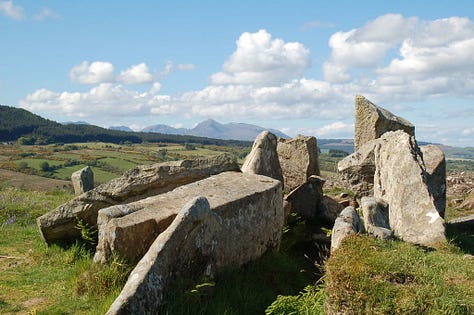
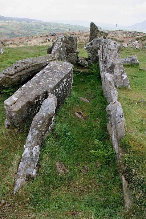
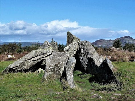

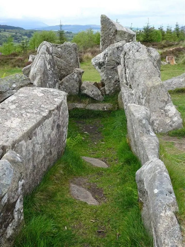


Several Bronze Age sites have been excavated, including Ossian's Mound near Clachaig and a cairn near Blackwaterfoot that produced a bronze dagger and a gold fillet. Torr a' Chaisteal Dun in the south west near Sliddery is the ruin of an Iron Age fortified structure dating from about AD 200. The original walls would have been 3 metres (9.8 ft) or more thick and enclosed a circular area about 14 metres (46 ft) in diameter.
In 2019, a Lidar survey reveals 1,000 ancient sites in Arran including a cursus.


Caral-Supe. Lima, Peru
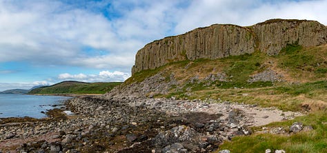
According to Wiki, Caral-Supe (also known as Caral and Norte Chico) was a complex pre-Columbian-era society that included as many as thirty major population centers in what is now the Caral region of north-central coastal Peru. The civilization flourished between the fourth and second millennia BC, with the formation of the first city generally dated to around 3500 BC, at Huaricanga, in the Fortaleza area. It is from 3100 BC onward that large-scale human settlement and communal construction become clearly apparent, which lasted until a period of decline around 1800 BC. Since the early twenty-first century, it has been established as the oldest-known civilization in the Americas, and as one of the six sites where civilisation separately originated in the ancient world.
This civilization flourished along three rivers, the Fortaleza, the Pativilca, and the Supe. These river valleys each have large clusters of sites. Farther south, there are several associated sites along the Huaura River. The alternative name, Caral-Supe, is derived from the city of Caral in the Supe Valley, a large and well-studied Caral-Supe site.
Complex society in Caral-Supe arose a millennium after Sumer in Mesopotamia, was contemporaneous with the Egyptian pyramids, and predated the Mesoamerican Olmec by nearly two millennia.
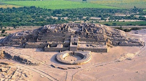


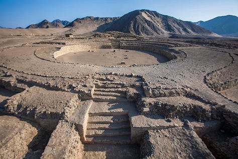
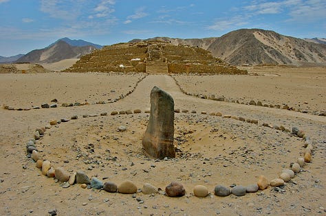
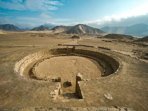
The radiocarbon work of Jonathan Haas et al., found that 10 of 95 samples taken in the Pativilca and Fortaleza areas dated from before 3500 BC. The oldest, dating from 9210 BC, provides "limited indication" of human settlement during the Pre-Columbian Early Archaic era. Two dates of 3700 BC are associated with communal architecture, but are likely to be anomalous.
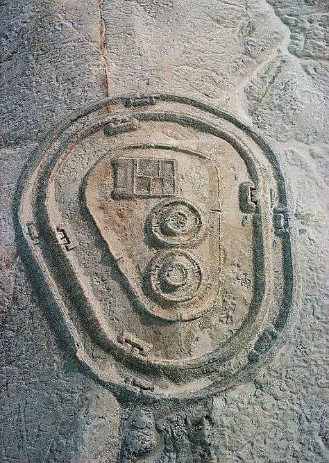

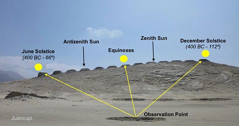
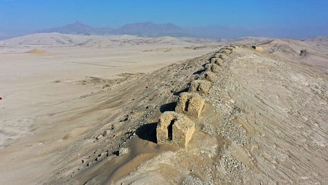
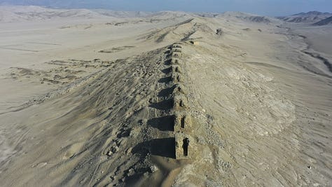
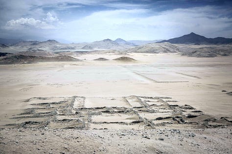
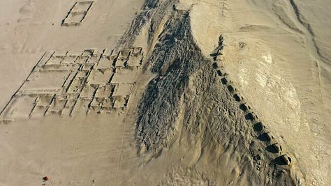

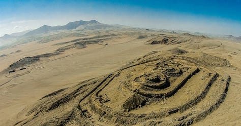
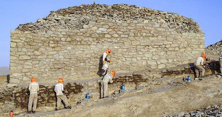
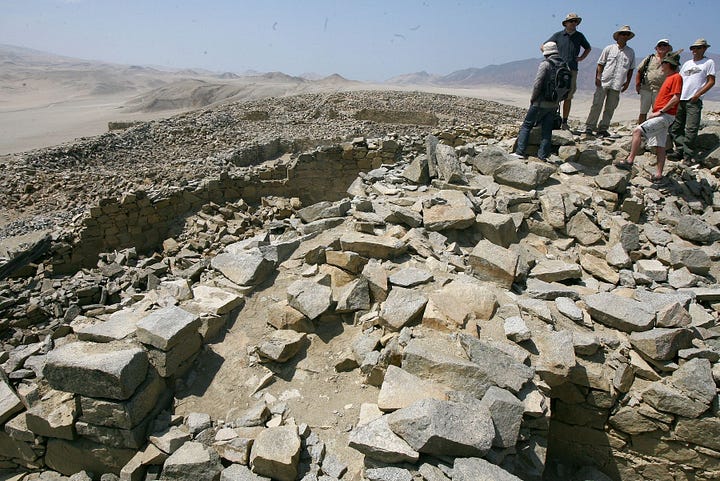
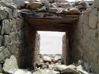
Chanquillo or Chankillo is an ancient monumental complex in the Peruvian coastal desert, found in the Casma-Sechin basin in the Ancash Department of Peru. The ruins include the hilltop Chankillo fort, the nearby Thirteen Towers solar observatory, and residential and gathering areas. The Thirteen Towers have been interpreted as an astronomical observatory built in the 4th century BC.

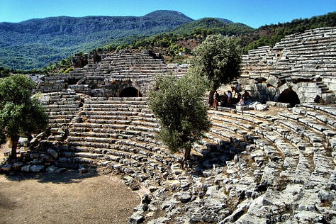
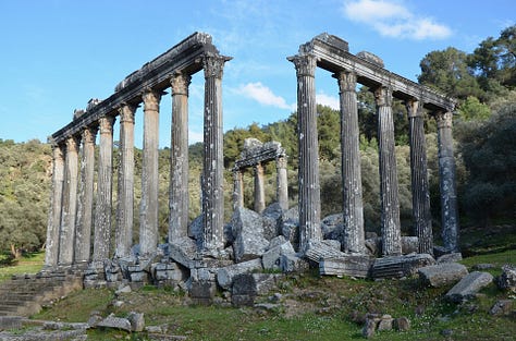
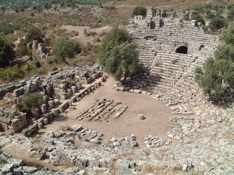
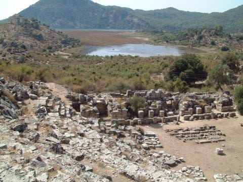
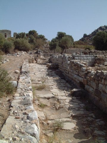
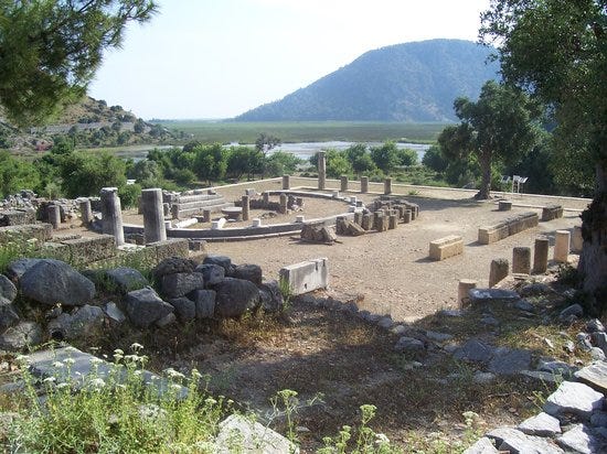
Caria (Land of Sheep), Asia Minor
According to Wiki, Caria (from Greek: Καρία, Karia; Turkish: Karya) was a region of western Anatolia extending along the coast from mid-Ionia (Mycale) south to Lycia and east to Phrygia. The Ionian and Dorian Greeks colonized the west of it and joined the Carian population in forming Greek-dominated states there. Carians were described by Herodotus as being of Minoan descent, while he reports that the Carians themselves maintained that they were Anatolian mainlanders intensely engaged in seafaring and were akin to the Mysians and the Lydians. The Carians spoke Carian, a native Anatolian language closely related to Luwian. Also closely associated with the Carians were the Leleges, which could be an earlier name for Carians.

Cromlehs & Dolmens
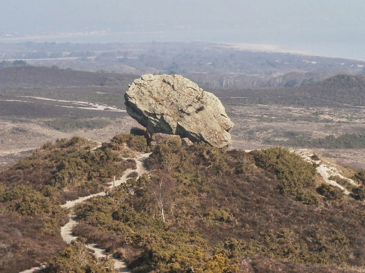
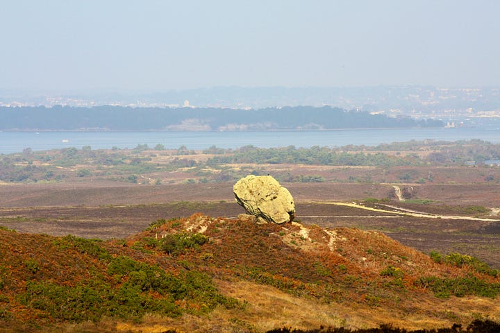
Agglestone Rock
According to Wiki, Agglestone Rock, also known as the Devil's Anvil, is a sandstone block of about 400 tonnes weight, perched on a conical hill, approximately 1-mile (1.6 km) from the village of Studland, south Dorset. Formerly an 'anvil' shape with a flat top, it fell onto one end and side in 1970, leaving the top at an angle of approximately 45°.
Dartmoor Kistvaens
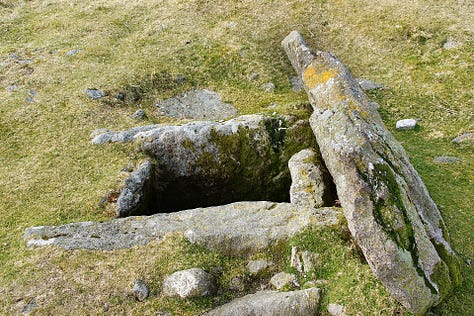
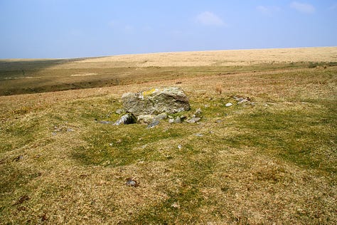
Dartmoor kistvaens are burial tombs or cists from the late Neolithic and early Bronze Age, i.e. from c 2500 BC to c 1500 BC. Kistvaens have been found in many places, including Dartmoor, a 954 km2 (368 square miles) area of moorland in south Devon, England. The box-like stone tombs were created when the ancient people of the area lived in hut circles. Cists are often to be found in the centre of a cairn circle although some appear solitary which could be the result of the loss of an original slight mound. There are over 180 known cists on Dartmoor although there could be up to 100 that remain buried underneath unexplored cairns. In the South West there are no cists to be found on the Quantock Hills, only 2 to be found on Exmoor and 58 to be found on Bodmin Moor. The Dartmoor cists are unique in that about 94% have the longer axis of the tomb orientated in a NW/SE direction It appears that Dartmoor cists were positioned in such a way that the deceased were facing the sun.
In August 2011 an untouched cist, on Whitehorse Hill, near Chagford, was the first to be excavated on the moor for over 100 years. This burial yielded some rare Bronze Age artefacts made of organic materials.

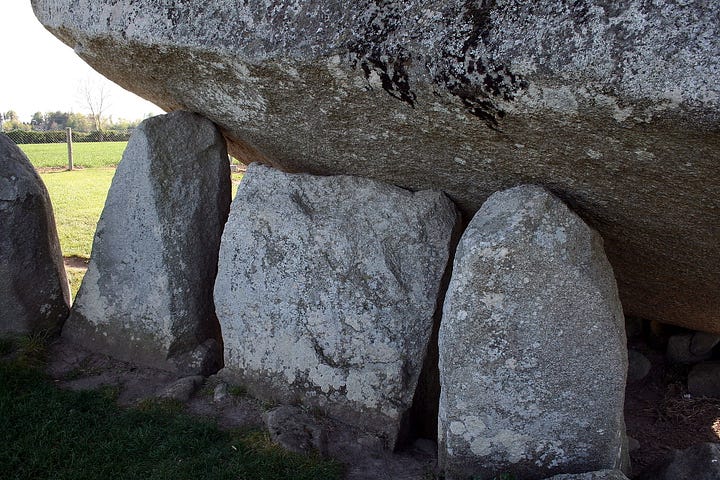
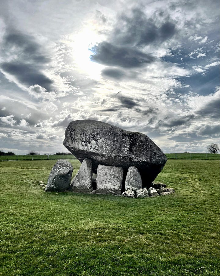
Brownshill Dolmen
According to Wiki, Brownshill Dolmen (Dolmain Chnoc an Bhrúnaigh in Irish) is a very large megalithic portal tomb situated 3 km east of Carlow, in County Carlow, Ireland. Its capstone weighs an estimated 150 metric tons, and is reputed to be the heaviest in Europe. The tomb is listed as a National Monument. Known as the Kernanstown Cromlech, sometimes spelled as Browneshill Dolmen, it is sited on the former estate house of the Browne family from which it takes its name.
The tomb was built between 4000 and 3000 BC (allegedly).


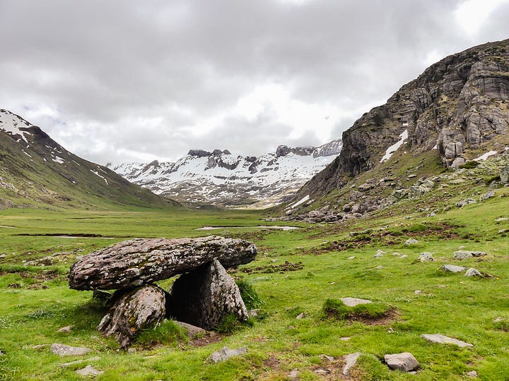
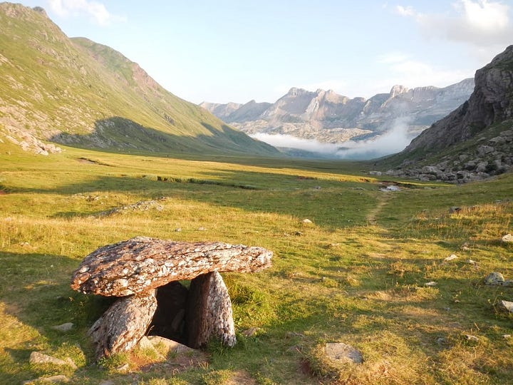
Dolmen of Aguas Tuerta
According to Patrimonio Cultural de Aragon, the dolmen of Aguas Tuertas is one of the best preserved megalithic monuments in the Aragon river valley, in the Aragonese Pyrenees. This dolmen is one of those of a simple chamber typology in which there are no signs of burial mound. Its interior chamber has a rectangular floor plan and is open to the Northwest.


Plas Newydd, Anglesey (Wales)
The Double Cromlech at Plas Newydd, Anglesey is a prehistoric burial chamber located in the park of the Marquess of Anglesey. It is situated 300 meters northeast of the shoreline of the Menai Straits at the south-side of the island of Anglesey, just opposite Plas Newydd House and Country Park, in whose "private" grounds it is situated. The cromlech was first marked as a cromlech on the OS map of 1841 and as Burial Chamber on the 1947 map, and later ones. Not much is known about them, so they may be modern creations.


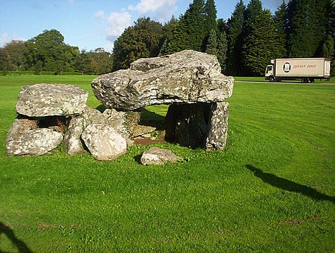
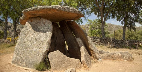
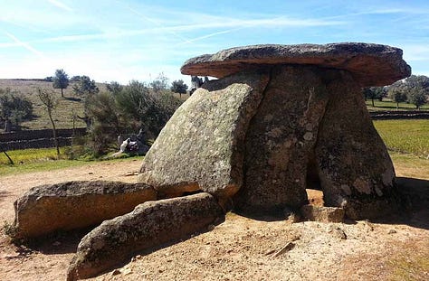
Valencia de Alcantara Dolmens, Spain
They are allegedly from the Neolithic and Chalcolithic periods, which spanned between the third and fourth millennium BC. Of note is that they are near the border of Portugal, which was a Phoenician hub.



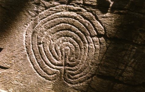
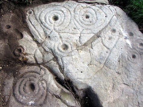
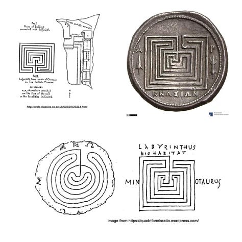
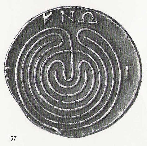
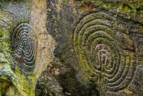
Cup & Ring Art
These are found all over Europe, but seem concentrated in Britain, Italy, and the Iberian Peninsula. Some of these are the seven-fold city of Troy symbolism, but some of them are not. I have seen no satisfactory explanation for what they are yet.



Pelasgic (Cyclopean/Polygonal) Masonry
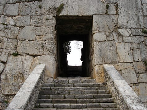
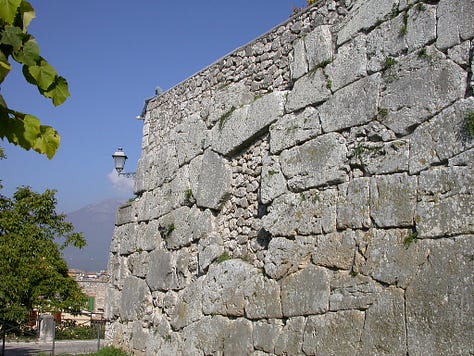
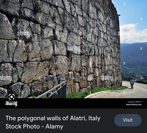
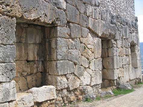
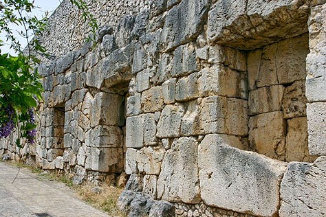
Acropolis of Alatri (Lazio, Italy)
According to Wiki, the area of the modern city was settled as early as the 2nd millennium BC. Aletrium was a town of the Hernici which, together with Veroli, Anagni and Ferentino, formed a defensive league against the Volsci and the Samnites around 550 BC.


Alba Fucens (Abruzzo, Italy)
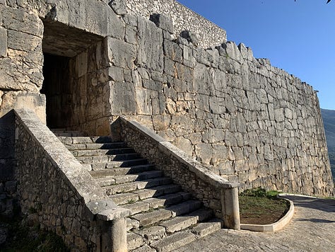
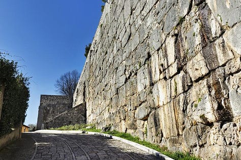
According to Wiki, it was originally a town of the Aequi, though on the frontier of the Marsi, but was occupied by a Latin colony (303-4 BC) owing to its strategic importance. Initially it was populated by 6,000 settlers who built a wall in the years immediately following their settlement. The following year they had to defend themselves from the attacks of the Aequi who, unable to tolerate the presence of a fortified Latin citadel on their territory, tried to conquer it without success.
It lay on a hill just to the north of the Via Valeria, which was prolonged beyond Tibur probably at this very period. In the Second Punic War Alba at first remained faithful and in 211 BC sent a contingent of 2,000 men to help Rome, but afterwards refused to send contingents and was punished.
Wiki makes no mention of an Etruscan, Phoenician, or Pelasgic origin, which is bizarre since that masonry belongs to them, unless the Romans are an extension of them and it is assumed.

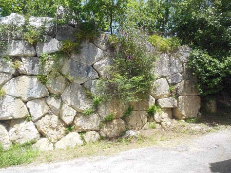
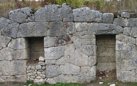
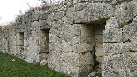
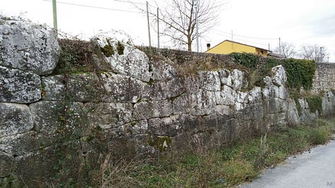
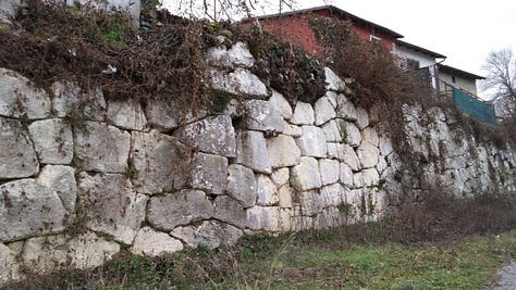
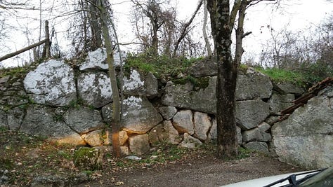
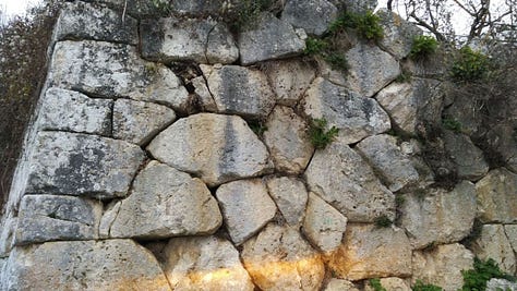
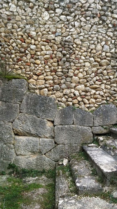
Amelia (Umbria, Italy)
According to Wiki, According to some scholars, Amelia is the oldest town in Umbria. It was supposedly founded by a legendary Umbrian king, King Ameroe, who gave the city the name Ameria. The city was later occupied by the Etruscans, and later still by the Romans, although it is not mentioned by name in the history of the Roman conquest of Umbria.
Is Ameria connected to America? Perhaps it’s anectdotal, but I just wanted to bring it to the table.
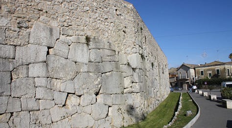
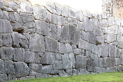
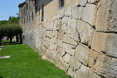
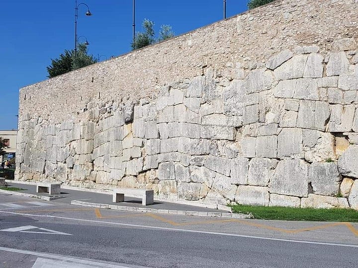


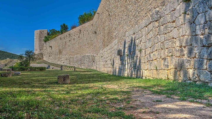
Civitavecchia di Arpino (Lazio, Italy)
According to Wiki, Civitavecchia (meaning "ancient town") is a city and comune of the Metropolitan City of Rome in the central Italian region of Lazio. A sea port on the Tyrrhenian Sea, it is located 60 kilometres (37 miles) west-north-west of Rome. The harbour is formed by two piers and a breakwater, on which stands a lighthouse. The whole territory of Civitavecchia is dotted with the remains of Etruscan tombs and it is likely that in the centre of the current city a small Etruscan settlement thrived. The Etruscan necropolis of Mattonara, not far from the Molinari factory, is almost certainly from the 7th - 6th century BC and was most likely connected with the nearby necropolis of Scaglia.

Cosa (Tuscany, Italy)
According to Wiki, Cosa was a Latin colony founded in southwestern Tuscany in 273 BC, on land confiscated from the Etruscans, to solidify the control of the Romans and offer the Republic a protected port. The Etruscan site (called Cusi or Cosia) may have been where modern Orbetello stands; a fortification wall in polygonal masonry at Orbetello's lagoon may be in phase with the walls of Cosa. The city wall of Cosa was built at the time of the foundation of the colony on 273 BCE. It is 1.5 kilometres (0.93 miles) long and built in polygonal masonry of Lugli's third type. It included a system of interval towers, numbering eighteen in all.
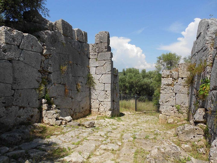
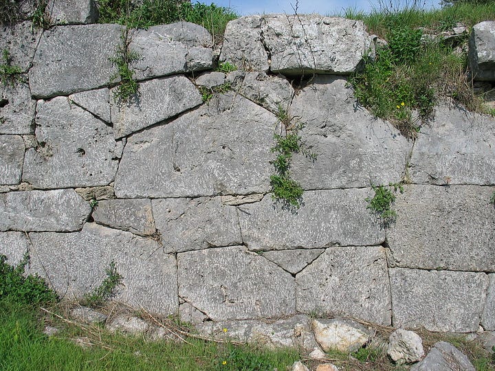


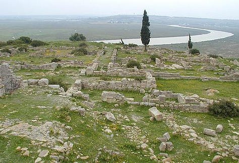
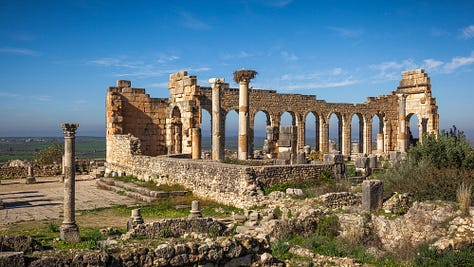
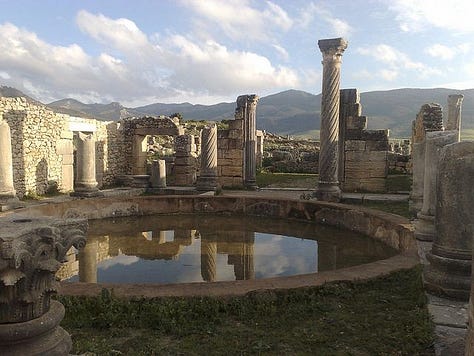
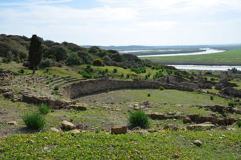
Lizus, Lixus (Volubilis, Morocco)
According to Wiki, Lixus is an ancient city founded by Phoenicians (8th-7th century BCE) before the city of Carthage. Its distinguishing feature is that it was continuously occupied from antiquity to the Islamic Era, and has ruins dating to the Phoenician (8th–6th centuries BCE), Punic (5th–3rd centuries BCE), Mauretanian (2nd century BCE–CE 50), Roman (CE 50–6th century CE) and Islamic (12th–15th centuries CE) periods.
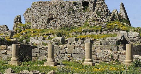


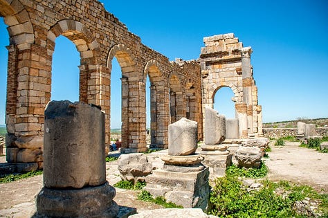
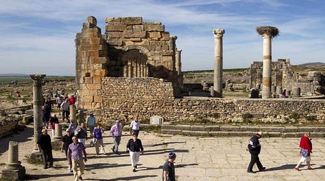
Norba (Latium, Italy)
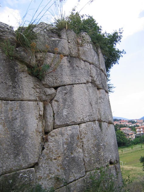
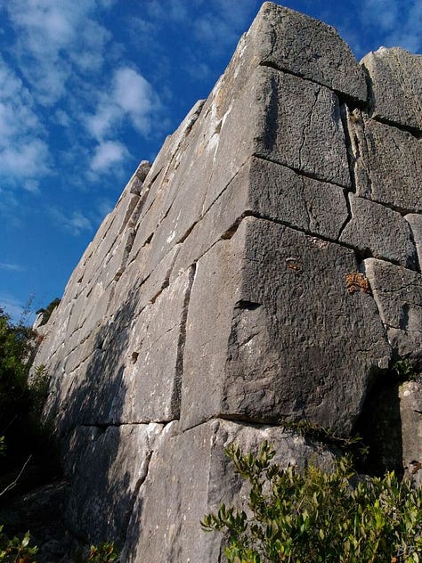
According to Wiki, Norba, an ancient town of Latium (Adjectum), Italy. It is situated 1 mile northwest of the modern town of Norma, on the western edge of the Volscian Mountains or Monti Lepini. The town is perched above a precipitous cliff with a splendid view over the Pomptine Marshes below; the highest point stands to ca. 460 meters (over 1500 feet) above sea level.
Norba was a member of the Latin League of 499 BC. It became a Roman colony in 492 BC, initially to protect the border with the Volsci, and later serving as an important fortress guarding the Pomptine Marshes. It served in 199 BC as a place of detention for the Carthaginian hostages, and was captured and destroyed by Sulla's troops during the civil wars at the end of 82 BC. By the first century AD Norba is included by Pliny the Elder on his list of extinct cities in Latium.
The sources conclude this site is exclusively Roman, and seem to be unaware that Cyclopean/polygonal masonry is Pelasgic (Phoenician). They also seem to be ignorant that Rome was quasi Etruscan, who I suspect are Phoenician.

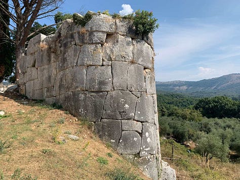
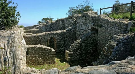
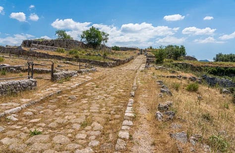


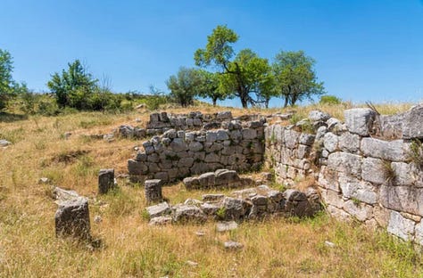
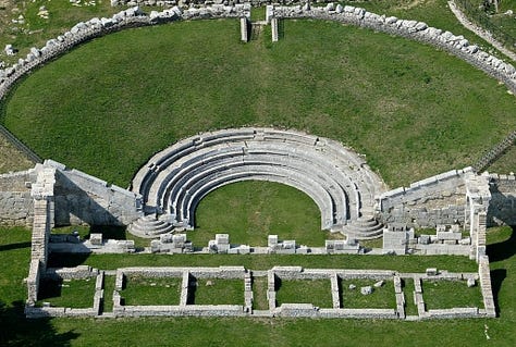
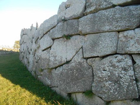
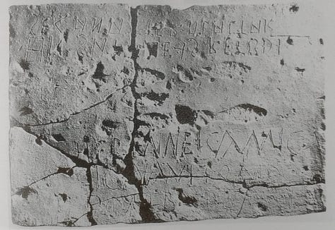
Pietrabbondante (Isernia, Italy)
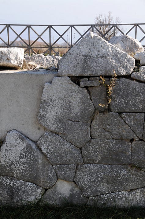
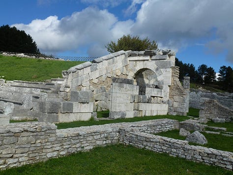
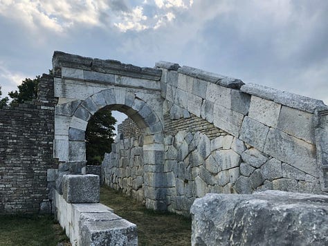
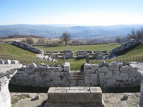
According to Wiki, Pietrabbondante's earliest known inhabitants were the Samnites, who arrived in Pietrabbondante in the 6th century BC. Many historians believe that it was home of the assemblies of the Samnite federal government. Although earlier scholarship thought this was the Samnite town called "Bovianum", this is now believed to be incorrect and the site is viewed as a Samnite sanctuary. The site has a single temple, a temple-theater complex, and numerous other structures. There seems to have been significant decrease in use after the loss of the Samnites and allies during the Social Wars, at the hands of Lucius Cornelius Sulla (89 BC).
Excavations in the 1840s brought to light sections of marble statues, clay tools, coins, weapons, etc. A very notable archeological find is the temple and the theater built of polygonal limestone that is a rare example of such a structure built by the Samnites.
Interesting that the Samnites are credited with being the earliest inhabitants. Why is the masonry Etrusco-Phoenician?


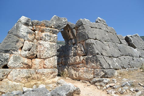
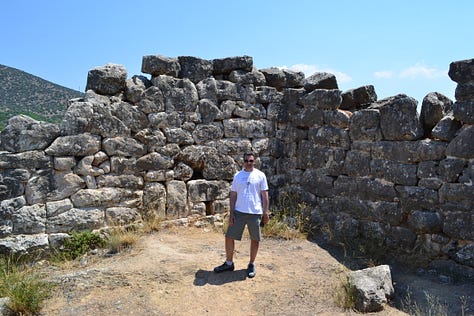
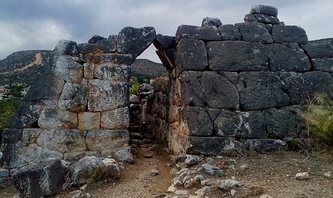
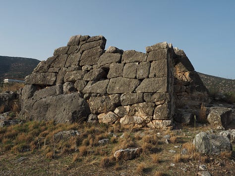
Pyramids of Argolis, Greece
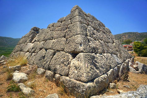
It’s unique to see pyramids also made with this type of masonry. The arch is the same as what’s seen in Civitavecchia. It’s documented that the Phoenicians were employed by the Pharaohs, but there are accounts (by Conon, the Greek General) and artifacts (Egyptian mummy wrapped in Etruscan script) that demonstrate the Phoenicians made Egyptian Thebes (Luxor) their capital.
According to Wiki, sampling was chosen for their firmness and lack of sun exposure of internal contact surfaces, by removing a few milligrams of powder from pieces in firm contact. Seven pieces gave an age range of c. 2500–2000 BC, while two ceramic sherds of non-diagnostic typology one from Hellenikon and one from Ligourio dated by TL and OSL gave concordant ages of 3000±250 BC and 660±200 BC respectively. This time frame would place construction of these structures at a time overlapping the construction of the pyramids in Egypt.



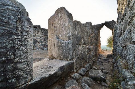
San Felice Circeo (Lazio, Italy)
According to Wiki, San Felice Circeo is a town and comune in the province of Latina, in the Lazio region of central Italy. It was an ancient city called Circeii. The origin of the name is uncertain: it has naturally been connected with Homer's legend of Circe.
At the east end of the promontory ridge are the remains of Bronze Age cyclopean walls that roughly form a rectangle of 200 by 100 metres. It seems to have been an acropolis and contains only a subterranean cistern with a beehive roof of converging blocks. The megalithic blocks are cut and assembled precisely together using tight polygonal joints without mortar. Many walls of this type were built during the Bronze Age in the Mediterranean, for example in Lazio those of Segni, Ferentino, Norba and Arpinum, possibly by the Aurunci people of the area. The blocks of the inner face are much less carefully worked both here and at Arpinum.
These citations dance around everything Etruscan without naming them. This is bizarre, and as my work suggests, it is part of the cover-up.
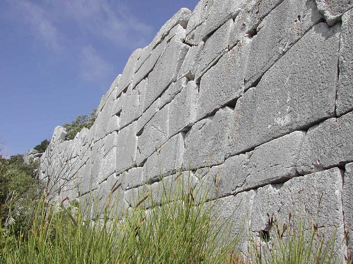

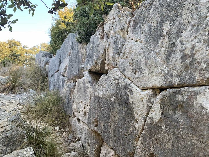
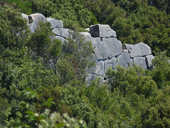
Rusellae (Tuscany)
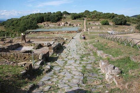
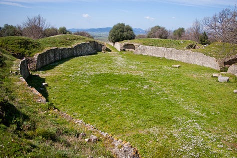
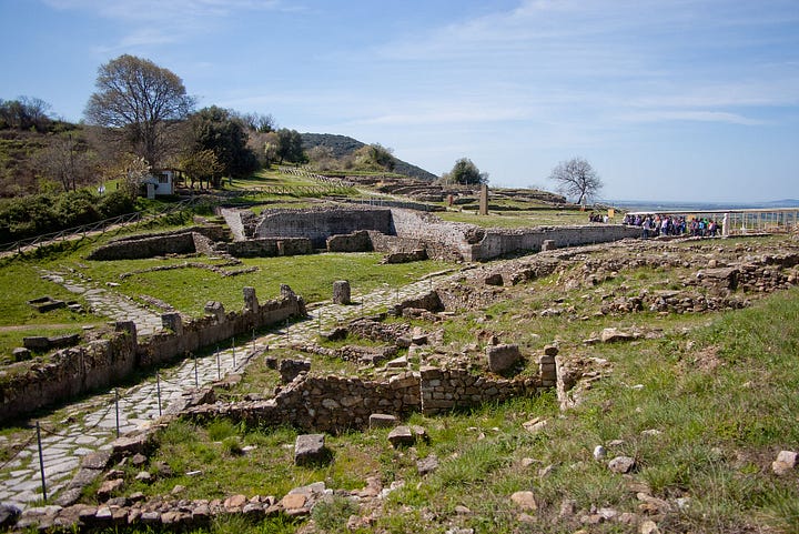
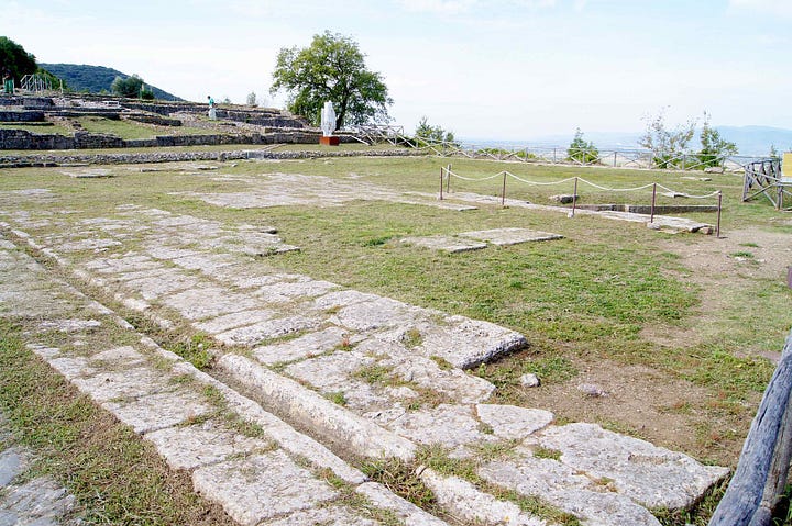
According to Wiki, Rusellae was an important ancient town of Etruria (roughly modern Tuscany), which survived until the Middle Ages before being abandoned. The impressive archaeological remains lie near the modern frazione or village of Roselle in the comune of Grosseto.
The remains of the ancient buildings were brought to light by means of a long campaign of excavations carried out under archaeologist Clelia Laviosa beginning in the 1950s. More recent work has revealed many more impressive buildings.
The first traces of settlement are shown in layers containing relics of Villanovan and at the end of 7th, early 6th century BC. Founded as a city in the 7th century BC, it was quoted by Dionysius of Halicarnassus as one of the cities that brought help to the Latins in the war against the Roman king Tarquinius Priscus. It developed to the detriment of neighbouring cities in particular Vetulonia.

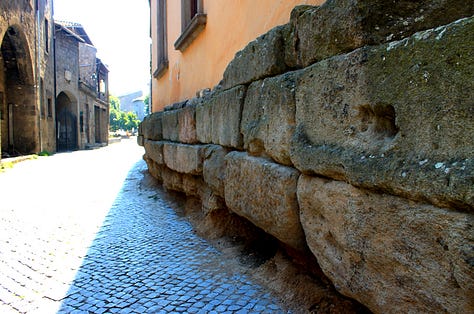
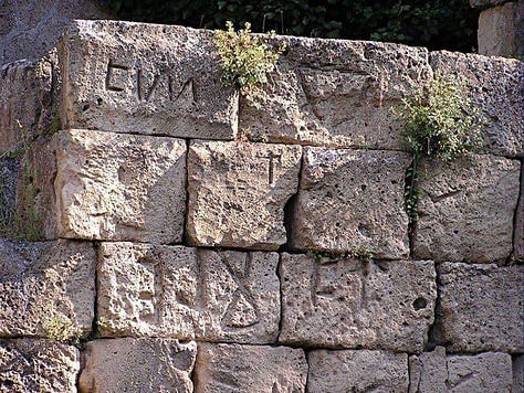
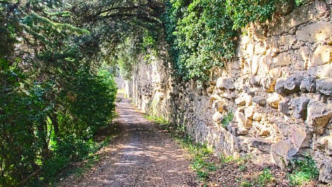
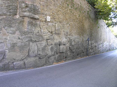
Mura Etrusche (Italy)

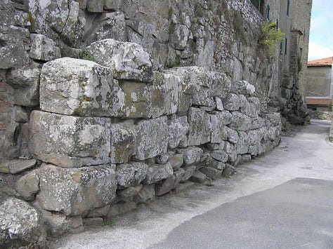

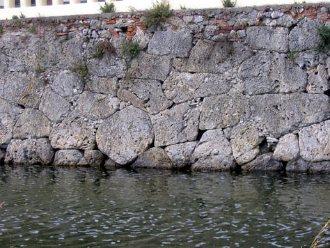
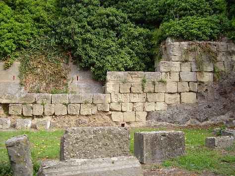
Vischongo (Ayacucho, Peru)
There is evidence of this style of masonry, especially that of what’s found at Alba Fucens (Italy). It is impossible to deny the diffusion. The only way this can be dismissed is if it’s a modern creation, inspired by Italian masonry.
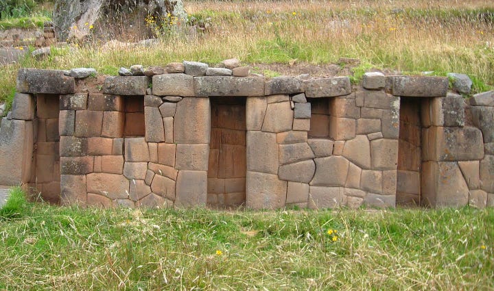
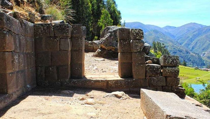
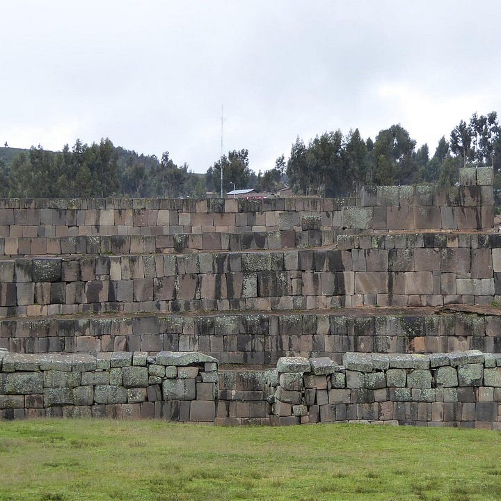
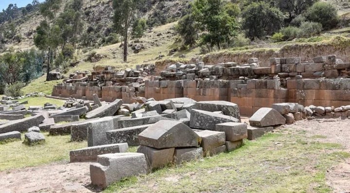
The most examples of this masonry are found in Italy. Why would anyone suggest it originated elsewhere?
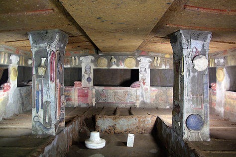
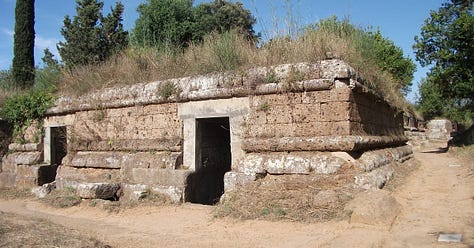
Etruscan Tombs (Cerveteri, Italy)
One of these pictures is not from Italy. Can you guess which one? If so, can you place it?


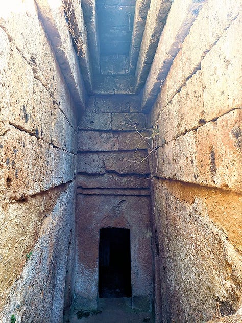
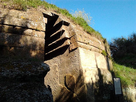
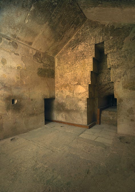
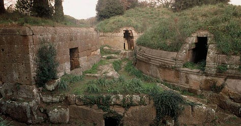

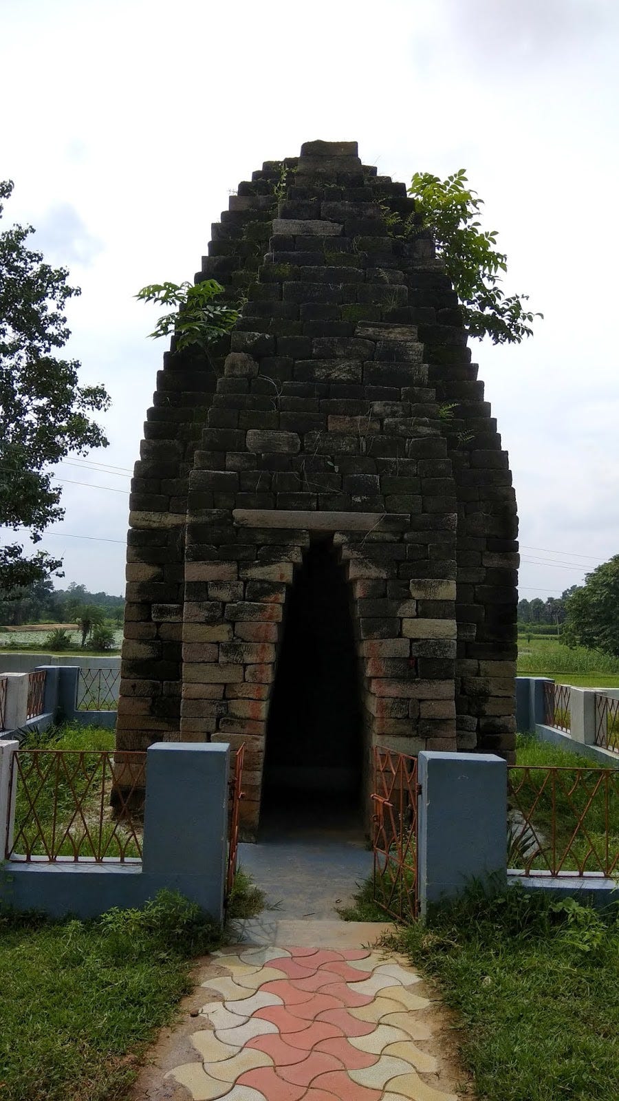
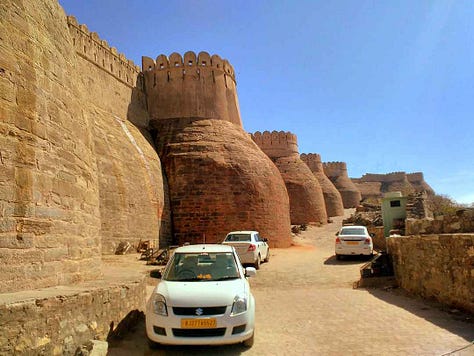
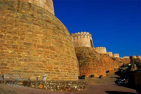
In an example of what may be cultural diffusion, here is a similar type of masonry in India, serving a similar function (unless I am mistaken; unfortunately, I didn’t keep as good of records as I ought to have, for I never intended to publish the photos).
Are you enjoying this article? Listen to The Holy Sailors (click the image). If you’ve never had an Audible trial, you can get it for free.
Funtana Coberta (Sardegna, Italy)
According to Wiki, The sacred well of Funtana Coberta is a building dating back to 1200 BC. and located a Ballao, in the province of Southern Sardinia, in Sardinia.
Archaeological excavations, started in 1918 from Antonio Taramelli and taken back in 1994 by Maria Rosaria Manunza, they allowed to start studying this sacred well and objects in bronze found, including swords for religious oaths, "ox leather" metal plates" is statuettes.
The structure and size of the well are similar, and may have a connection with the sacred well of Garlo, (I’m not going to include this sacred well unless Etruscan artifacts show up, but it does look like diffusion) a stone structure dating back to II millennium BC. (the craftsmanship does not look as good and the dating is absurd without artifacts) found in Thracian (Bulgaria) in the Struma river area, near the Aegean Sea.

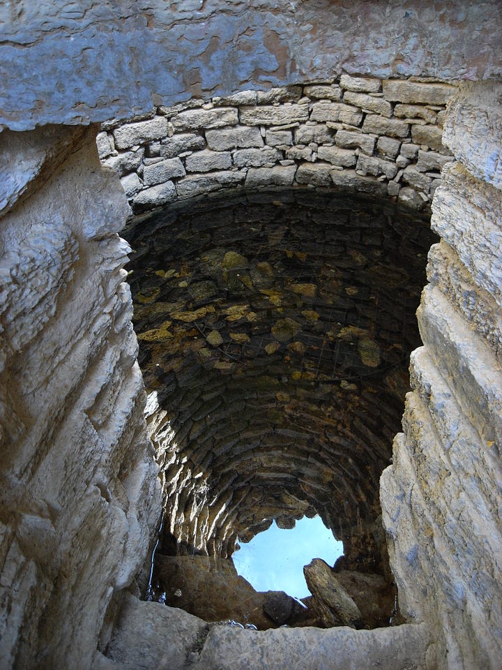

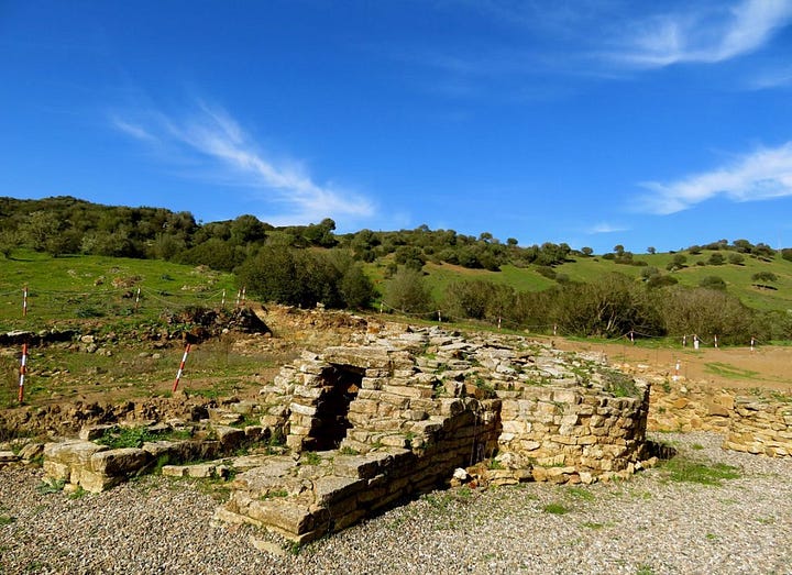
Under a first layer dating back to'Roman age a second layer was found in which the cultural elements are uniquely nuragic. In the "layer 150" was found of the ceramic, mainly from the period of medium bronze ( 2000 – 1550 BC ), but also of the recent Bronze Age ( 1550 – 1200 BC ). Therefore it can be deduced that the construction of the well is to be dated between the Middle Bronze Age and the recent Bronze Age.
In the oldest layer, a terracotta container was found with fragments of swords for religious oaths and metal plates "ox skin" inside". The container, by type, can be dated between the final and recent bronze period. Among the objects also found axes whose casting matrices were found near the nuraghe Albucciu ad Arzachena and similar to specimens of the British archipelago, of the Mycenaean civilization (Late Helladic III) and of Troy VIIb.
Considering the studies of the archaeologist Fulvia Lo Schiavo, for whom the production of "ox leather" slabs ends before the end of the Bronze Age, according to the scholar Maria Rosaria Manunza it is likely that what was found inside the container can be dated between the recent Bronze period and the final Bronze Age.
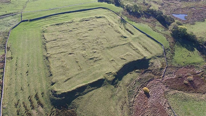
Habitancum (Britain)
According to Wiki, Habitancum was an ancient Roman fort (castrum) located at Risingham, Northumberland, England. The fort was one of the defensive structures built along Dere Street, a Roman road running from York to Corbridge and onwards to Melrose in what is now Scotland.
The fort's name is from Habitanci on an altar set up by Marcus Gavius Secundinus, a consular beneficiary on duty there. It is not mentioned in other sources such as the Notitia Dignitatum. Evidensca in the Ravenna Cosmography is highly unlikely to be a corrupted version of this name.
Not much is known about the history of this location, and there are accounts of Ogmios effigies being unearthed, which, if authentic, indicates a Phoenician settlement.

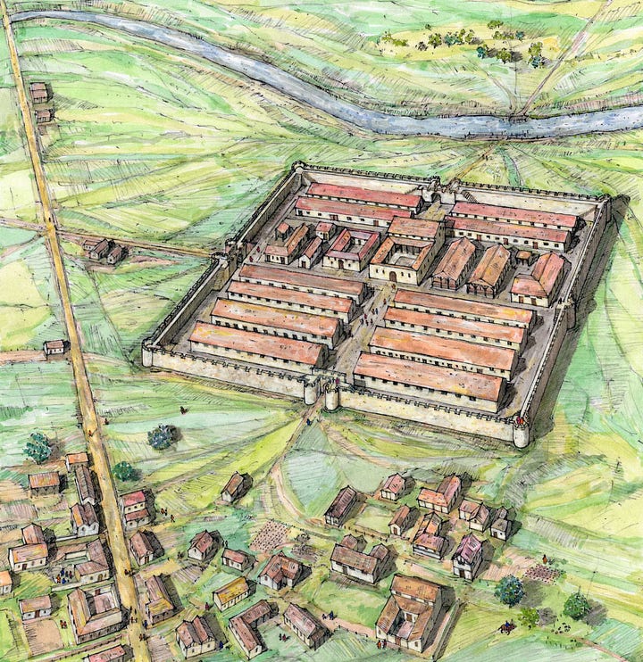
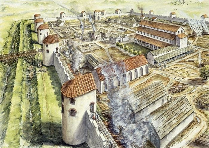
Hadrian's Wall (North England)
According to Wiki, Hadrian's Wall (Latin: Vallum Aelium), also known as the Roman Wall, Picts' Wall, or Vallum Hadriani in Latin, is a former defensive fortification of the Roman province of Britannia, begun in AD 122 in the reign of the Emperor Hadrian. Running from Wallsend on the River Tyne in the east to Bowness-on-Solway in the west of what is now northern England, it was a stone wall with large ditches in front of it and behind it that crossed the whole width of the island. Soldiers were garrisoned along the line of the wall in large forts, smaller milecastles and intervening turrets. In addition to the wall's defensive military role, its gates may have been customs posts.
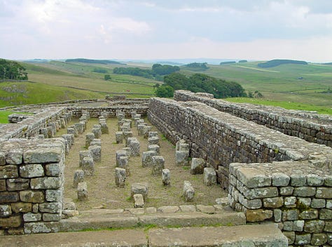
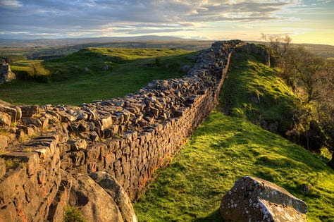
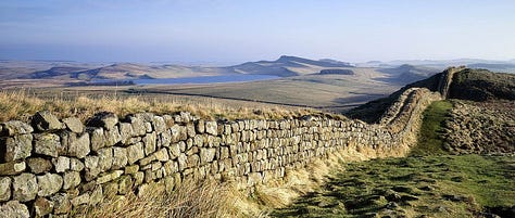
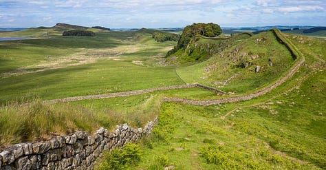
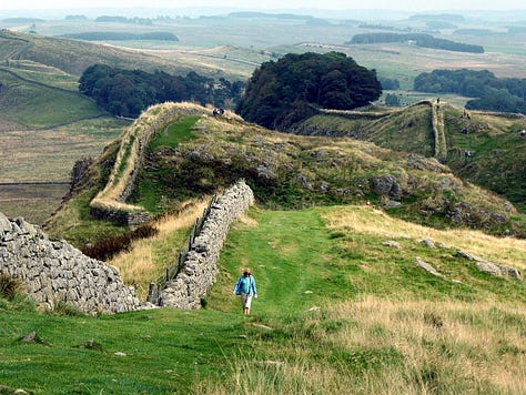
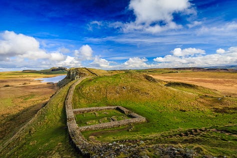


Hadrian's Wall marked the boundary between Roman Britannia and unconquered Caledonia to the north. The wall lies entirely within England and has never formed the Anglo-Scottish border, though it is often loosely or colloquially described as being such.
I find it extremely suspicious to claim that an invading empire that had such difficulty fighting the inhabitants also had the luxury to build a wall across the entire continent, which, Britain is essentially. It isn’t connected to mainland Europe and shouldn’t be considered a part of it.
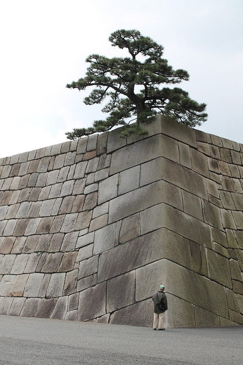
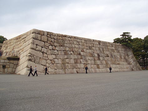
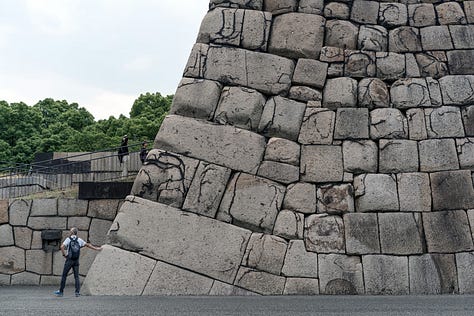
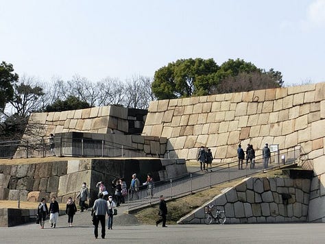
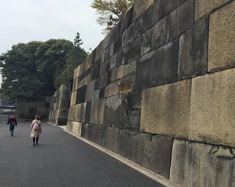
Imperial Palace (Japan)
According to the status quo, Edo Castle was built in the Middle Ages. However, there does not seem to be much information available in English on how they built those walls, and some of them are in a Pelasgic style. Till more information emerges, anything I have to say would just be speculative, but if any of you are Japanese speakers and can point people in the right direction, post links in the comments sections.



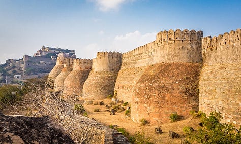
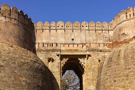
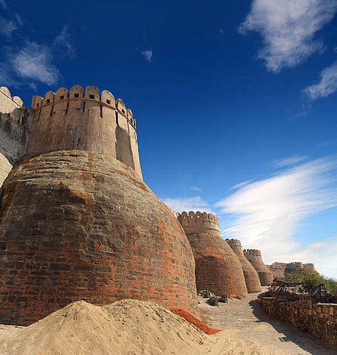
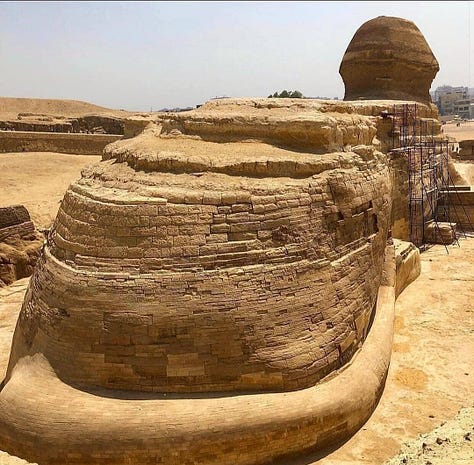
Kumbhalgarh Fort Wall (India) and Sphinx (Egypt)
This is an inquiry, not a claim. Egypt has a heavy Indian influence, and seeing some of the masonry in India made me wonder if there is a connection in the style that would lead to or support a possible diffusion between these eras. According to Wiki, the early history of the fort could not be ascertained on account of lack of evidence (a typical roadblock that researches come to regarding Indian history). Before Rana Kumbha built the new fort, there was a small fort, limited to small hilly area, believed to have been built by King Samprati of the Maurya (recall the Phoenician Maur, meaning Great, Lord, Prince, hence names like Mauro) and was known as Matsyaendra Durg. Rana Lakha won this entire area and plains of Godwar from Chauhan Rajputs of Nadol in late 14th century.



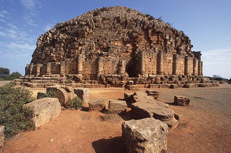
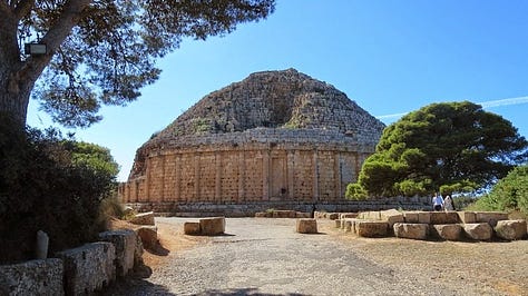
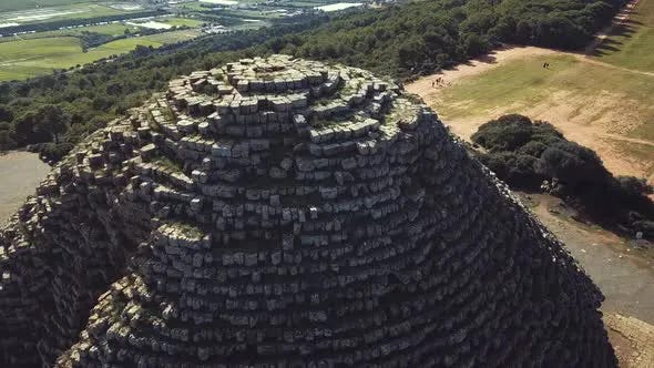
Mausoleum of Mauretania (Algeria, North Africa)
According to Wiki, The Royal Mausoleum of Mauretania is a funerary monument located on the road between Cherchell and Algiers, in Tipaza Province, Algeria. The mausoleum is the tomb where the Numidian Berber King Juba II (son of Juba I of Numidia) and the Queen Cleopatra Selene II, sovereigns of Numidia and Mauretania Caesariensis, were allegedly buried. However, their human remains have not been found at the site, perhaps due to tomb raiding.
In other words, not much is known about the site, and it should remain a place of interest because Maur is a Phoenician word that has nothing to do with Arabs or Moors, whence the Roman Mars comes, and this part of the world was civilized by Phoenicians.


Nuraghi/Pictish Towers
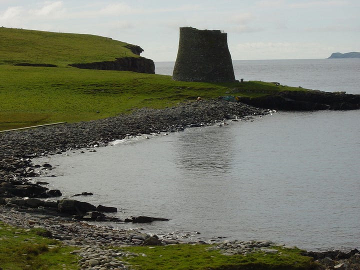
Mousa Broch (Scotland)
The Highland language of the ancient Irish and Wild Scots has the same 17 letters that the Phoenicians gave to the Greeks c. 500 BC. Britain is named by Phoenicians and it was also peopled by them. Until there is no doubt left, ancient sites in Britain must remain of interest in terms of proving cultural diffusion between it and ancient Italy. According to Wiki, Broch of Mousa (or Mousa Broch) is a preserved Iron Age broch or round tower. It is on the island of Mousa in Shetland, Scotland. It is the tallest broch still standing and amongst the best-preserved prehistoric buildings in Europe. It is thought to have been constructed c. 100 BC, and is one of more than 500 brochs built in Scotland.


The Nuragic civilization, also known as the Nuragic culture, was a civilization or culture on the Mediterranean island of Sardinia, which lasted from the 18th century BCE (Middle Bronze Age) (or from the 23rd century BCE) up to the Roman colonization in 238 BCE. Others date the culture as lasting at least until the 2nd century AD and in some areas, namely the Barbagia, to the 6th century AD or possibly even to the 11th century AD.
Are they connected through cultural diffusion?
Nuraghe Is Paras (Sardegna)
According to Wiki, the nuraghe Is Paras is an archeological site of Isili, a town in the historical region of Sarcidano, province of South Sardinia.
The nuraghe is located in a strategic position dominating the underlying territories open to the West. Its shape is that of a trilobate nuraghe, formed by a triangular bastion with three towers at the corners.
According to the archaeologist Giovanni Lilliu its tholos is the largest and most harmonious of all those present in Sardinia. The diameter of the base of the tower is of about 12,50 meters, its tholos chamber reached a height of 11,80 meters, making it the tallest dome in the world when it was built in the 15-14th century bc, it was surpassed by the underground tholos of the tomb of Atreus one or two centuries later. Inside the main tower there's a circular well. Originally there was an additional chamber on top of the first one, which would be reached through the still partially extant spiral staircase. Three smaller towers were added around the main one during the 13th century bc and connected by a wall. The complex was in turn surrounded by an external wall with towers.


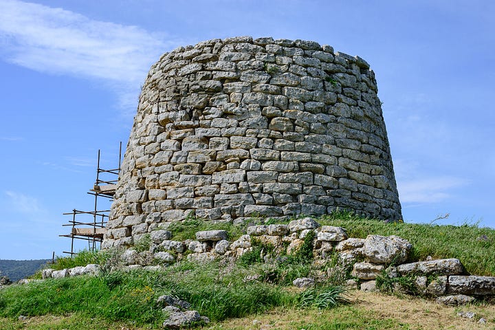
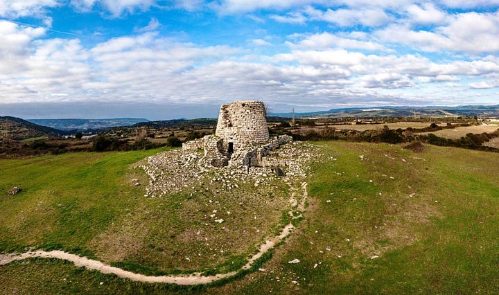
Nuraghe Longu di Padria (Sardegna)
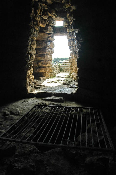
According to this source, “The monument, which is ‘bilobato’ with lateral additions, presents a beautiful brick ornament in polygonal blocks of basalt put in regular rows.
The entrance to the castle tower, in a trapezoidal light with a small emptying window above, leads into a corridor with an ogive roof, bevelled towards the inside that leads to the room with a round plant and a tholos roof. On the right of the room a niche opens, on the left the stairs that lead to the floor above, of which only a few rows remain. On the side of the stairs, to the south-east, a big window with an architrave opens up. In front of the main tower, in a period after the building of the nuraghe, to the right a strong wall and to the left two towers that face each other in a small yard have been placed against the nuraghe.
The remains of an extended village from the same period as the nuraghe and structures that can be traced back to historical time are clearly visible around it.
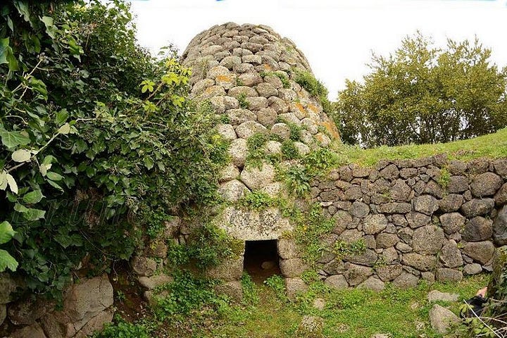
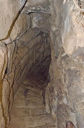


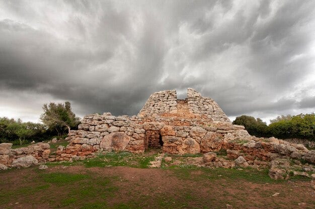
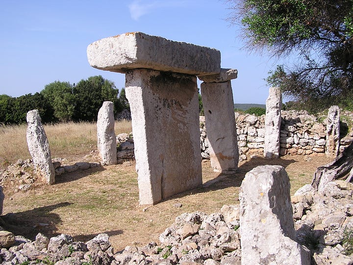
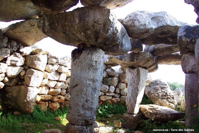
Nuraghe Menorca, Balearic Islands (Spain)
According to Megalithic Portal, Talaiots date from the late second millennium BC and early first millennium BC. There are at least 274 of them, in, near, or related to Talaiotic settlements and Talaiotic navetes. While some certainly had a defensive purpose, the purpose of others is not clearly understood.

Nulvi of Irru, Sardegna (Nuragic)
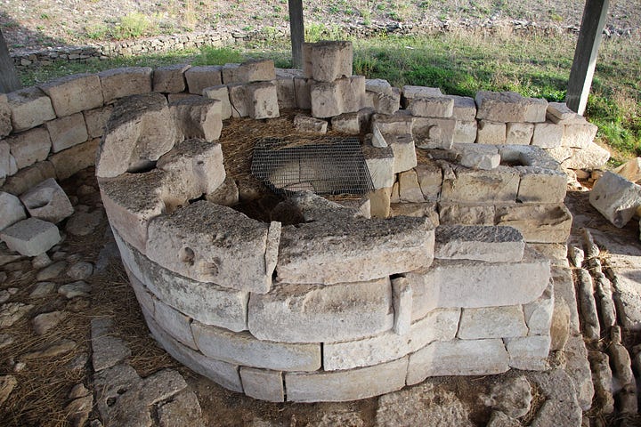
According to Wiki, Nulvi is a comune (municipality) in the Province of Sassari in the Italian region Sardinia, located about 180 kilometres (110 miles) north of Cagliari and about 20 kilometres (12 miles) northeast of Sassari. It is one of the main centers of the Anglona historical regione.
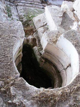
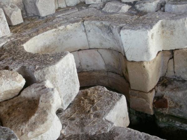
It looks like an ancient well.

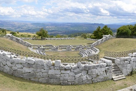
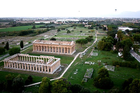
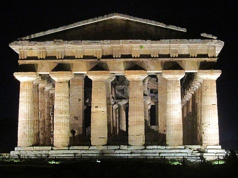
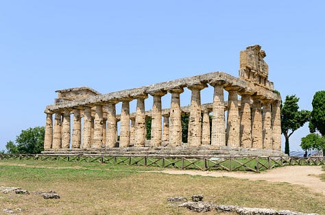
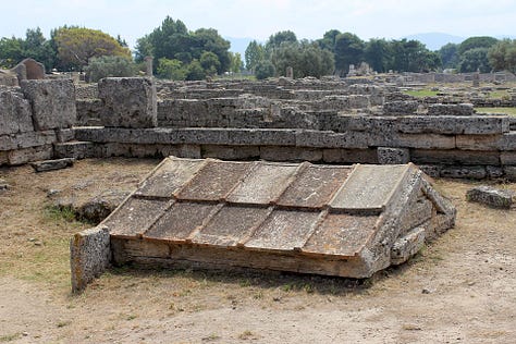
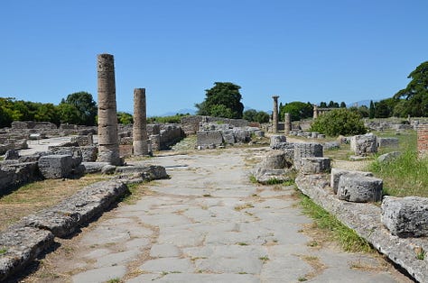
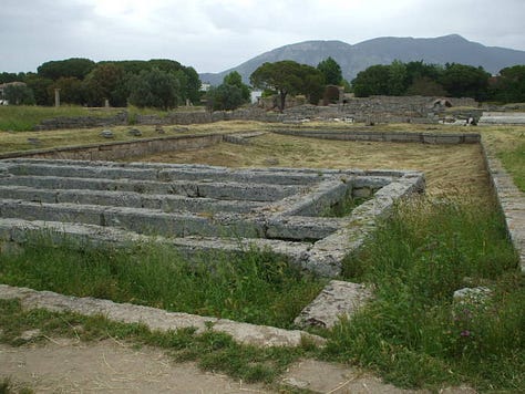
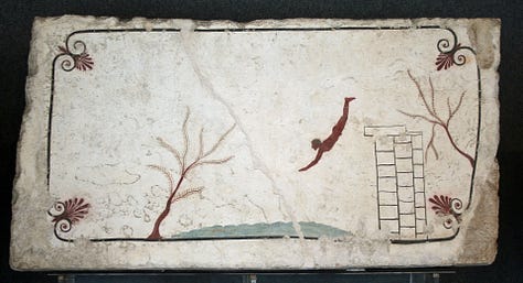
Paestum (Campania, Italy)
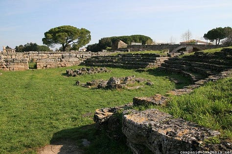
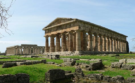
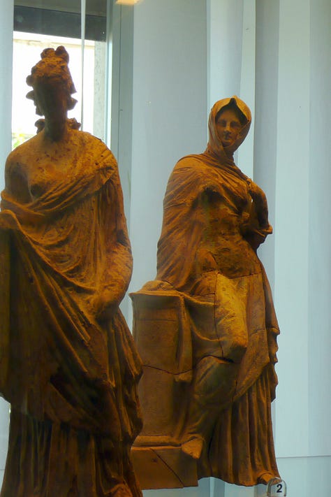
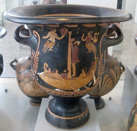
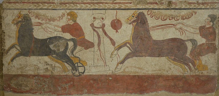
I don’t accept the history of Paestum, as my work has exposed a massive farrago between Greek and Etruscan culture. According to Wiki, much of the most celebrated features of the site today are the three large temples in the Archaic version of the Greek Doric order, dating from about 550 to 450 BC, however, many of the techniques and language they’ve assumed were Greek turned out to be Etruscan, which is why this site remains of interest.





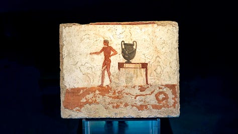
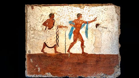
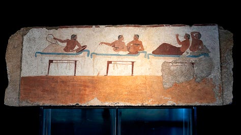

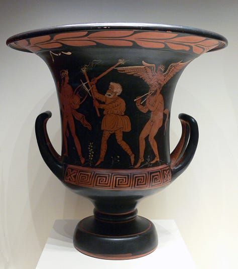


Pozzo Sacro di Predio (Perfugas, Italy)
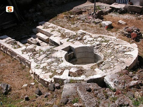
According to Wiki, the sacred well by Predio Canopoli it is a monument nuragic located within the historic center of Perfugas, in province of Sassari, in front of the parish church of Santa Maria degli Angeli.
Dating back to the period of Medium bronze, was discovered casually in the 1923, during water search operations carried out by the then owner of the predio Domenico Canopoli, and excavated the following year by the archaeologist Antonio Taramelli. This monument represents one of the most refined examples of architecture connected to the cult of water.
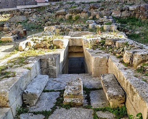
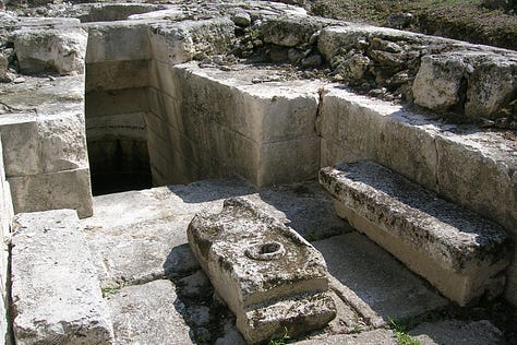
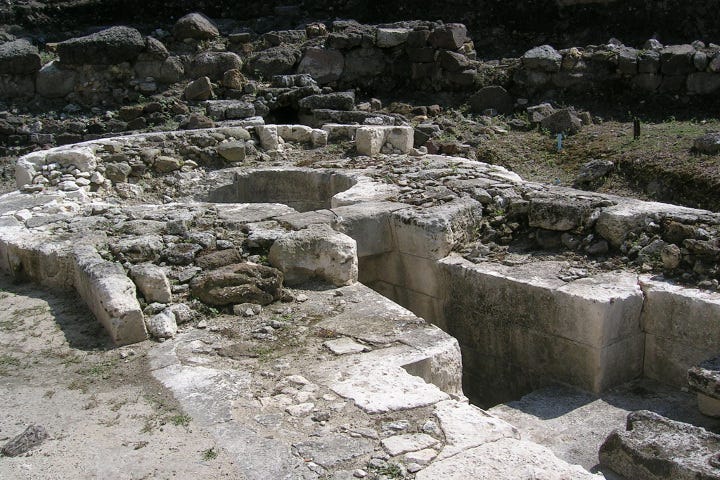
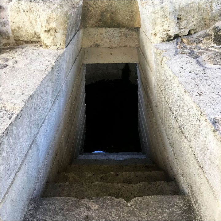
Su Tempiesu (Sacred Fountain), Italy
According to Wiki, Su Tempiesu is the best preserved Well sanctuary (Italian Pozzo sacro) on Sardinia and one of the few well-preserved examples of architecture from the Nuragic period. It is east of Orune in the Nuoro Province on a steep slope in a remote valley.
The small temple was built by the Nuragic culture for the Water cult built and originated in the late period. Thanks to a landslide that covered him until 1953 ( the year of his discovery ), he was largely preserved in his above-ground part.
I also want to bring attention to some of these sites not being discovered till the 20th century and what that could implicate.
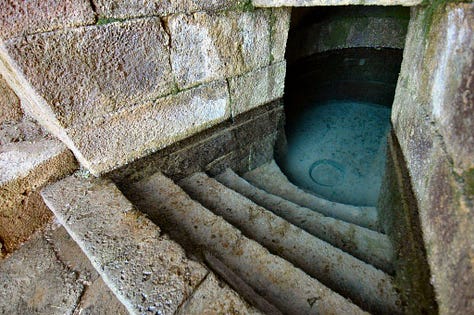
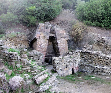
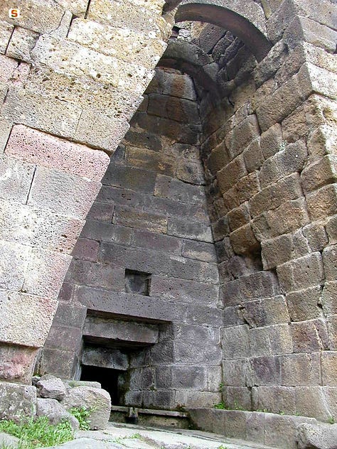
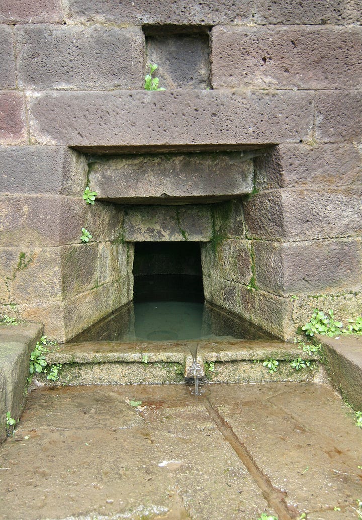
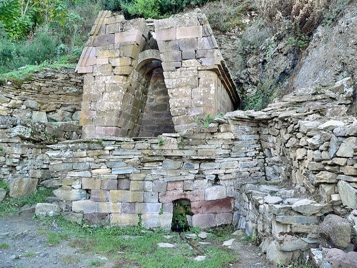
Rocche di Cusa, Sicily
According to Wiki, Cave di Cusa or Rocche di Cusa was an ancient stone quarry in Sicily. It is located 3 kilometers south of the town Campobello di Mazara in the province of Trapani, Italy. It is 1.8 kilometer long and is on a ridge that spans from east to west. This site was quarried beginning in the first half of the 6th century BC and its stone was used to construct the temples in the ancient Greek city Selinunte. It was abandoned in 409 BC when the city was captured by the Carthaginians.
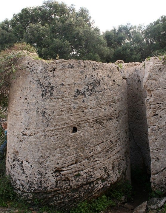
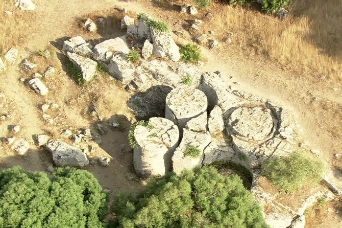


Sa Testa, Olbia (Pozzo Sacro)
According to this source, uncovered in the 1930s when locals were searching for fresh water springs, it comes to no surprise that the sacred well known as sa Testa had been chosen by the Nuragic Age settlers to honour their water divinities. Today it is a site very popular with archaeology enthusiasts, especially those studying Nuragic culture. The old shrine dates to between XV and XIII centuries BCE and sits just outside of the town of Olbia.
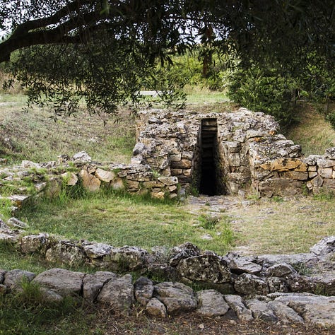

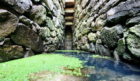
Santa Cristina Well (Sardegna)
According to this source, Santa Cristina's well is distinguished by its perfectly flat walls and clean masonry. It is not like most Nuragic buildings. The well's entrance is also quite wide, something that is not possible with other similar structures. The well is a good place to observe celestial bodies. On the days of the autumn and spring equinox, the Sun reflects off the source's surface and illuminates the well's inner space. It was also discovered that the moonlight, when at its highest height, only once every 18 years and six months, enters the hole in the roof of a well.
Without a demonstration of this, I have no opinion on it, but if it’s true, it is amazing even if it’s not an ancient structure. That 18.5 years is close, but not exact to the Metonic cycle and the use of 19 stones at locations in Britain. Are they related?

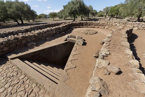
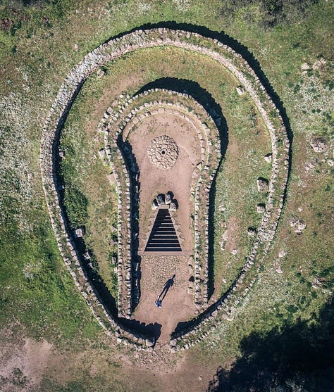
Sardegna (Italy)
If the findings in Sardegna are authentic, I suspect it is one of the most important locations of the ancient universal maritime empire that my work uncovers. According to Wiki, Sardinia is the second-largest island in the Mediterranean Sea, after Sicily, and one of the 20 regions of Italy. It is located west of the Italian Peninsula, north of Tunisia and immediately south of the French island of Corsica.
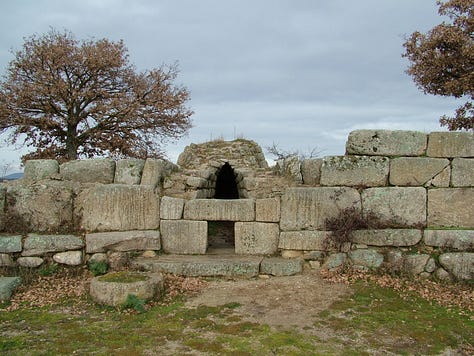
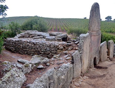


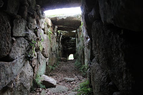
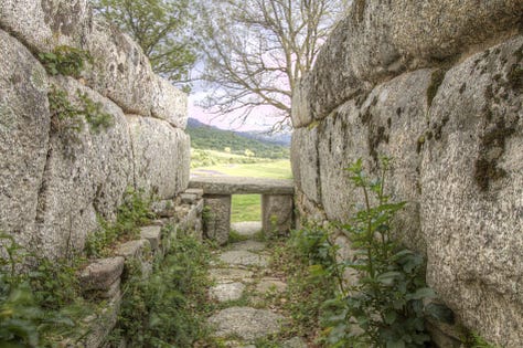
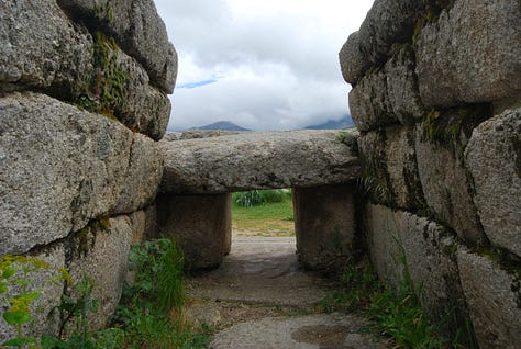
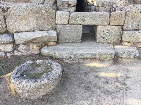

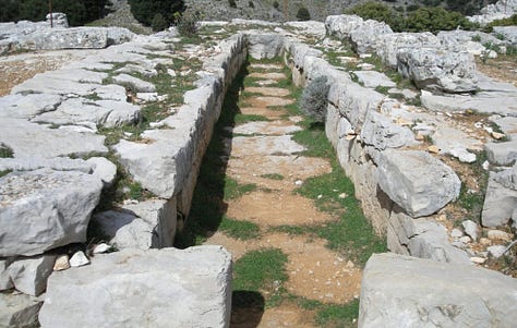

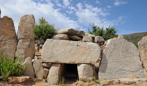
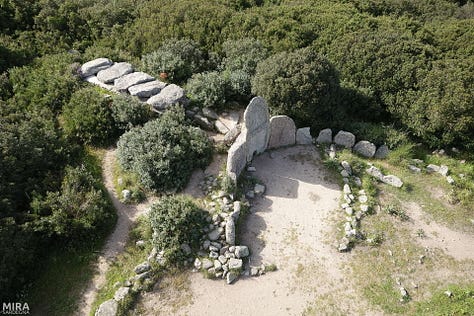
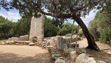
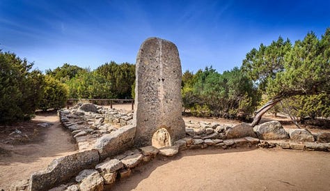
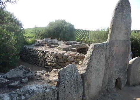
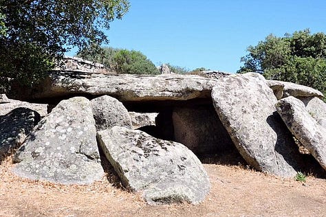
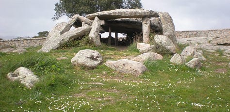
Sardinia's indigenous language and Algherese Catalan are referred to by both the regional and national law as two of Italy's twelve officially recognized linguistic minorities, albeit gravely endangered, while the regional law provides some measures to recognize and protect the aforementioned as well as the island's other minority languages (the Corsican-influenced Sassarese and Gallurese, and finally Tabarchino Ligurian).

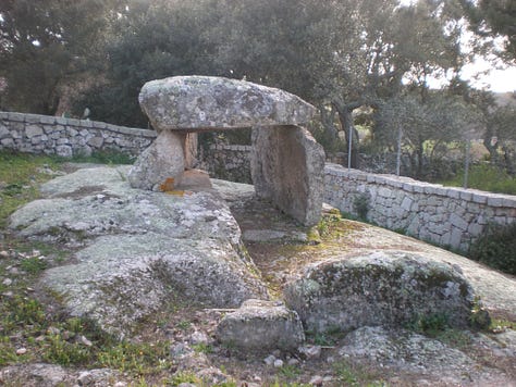
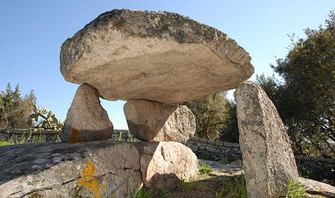
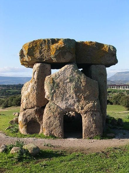


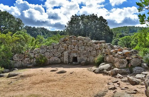
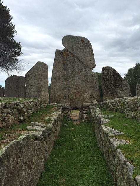

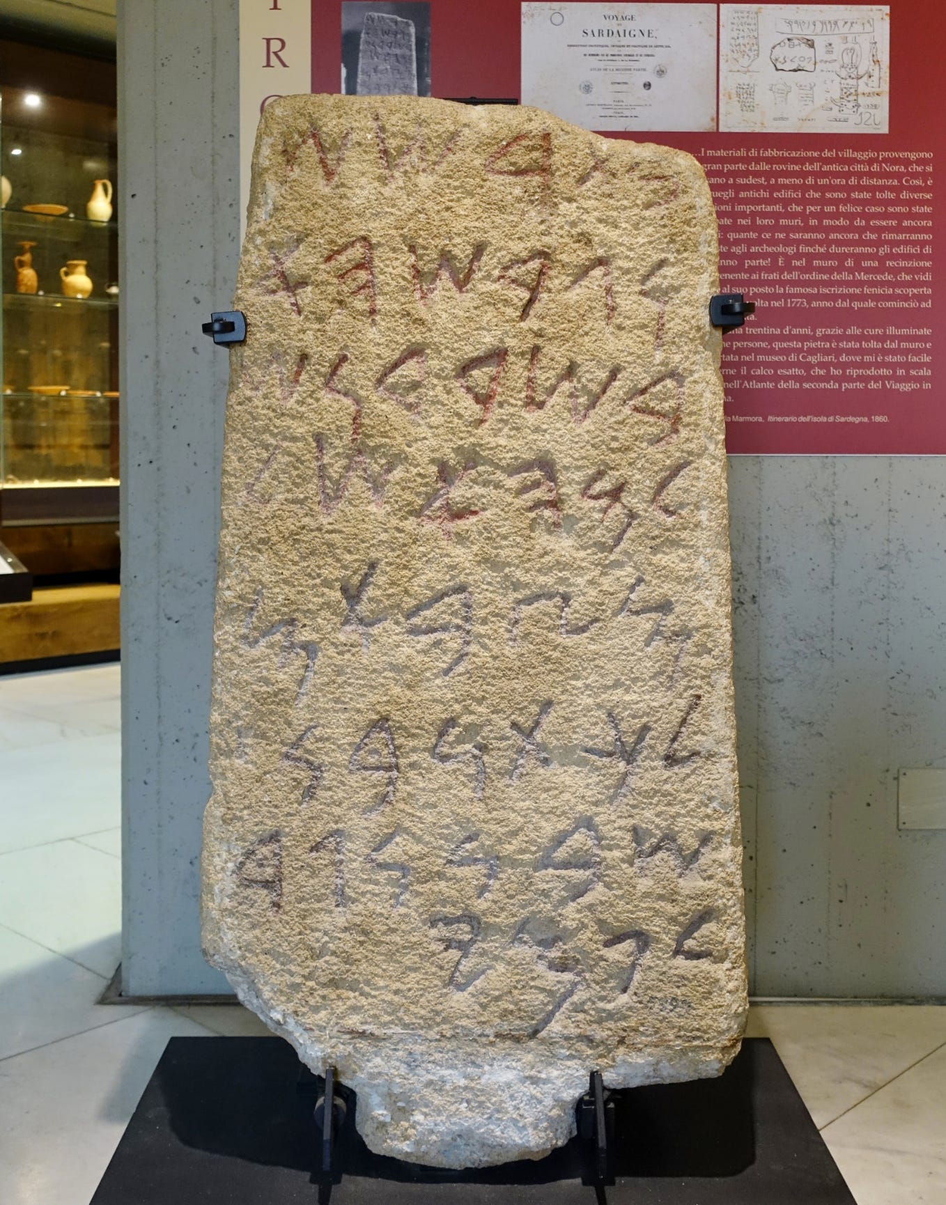
The name Sardinia has pre-Latin roots. It comes from the pre-Roman ethnonym *s(a)rd-, later romanised as sardus (feminine sarda). It makes its first appearance on the Nora Stone, where the word ŠRDN, or *Šardana, testifies to the name's existence when the Phoenician merchants first arrived. The Nora Stone or Nora Inscription is an ancient Phoenician inscribed stone found at Nora on the south coast of Sardinia in 1773.
According to Timaeus, one of Plato's dialogues, Sardinia (referred to by most ancient Greek authors as Sardṓ, Σαρδώ) and its people as well might have been named after a legendary woman called Sardṓ (Σαρδώ), born in Sardis (Σάρδεις), capital of the ancient Kingdom of Lydia. There has also been speculation that identifies the ancient Nuragic Sards with the Sherden, one of the Sea Peoples.

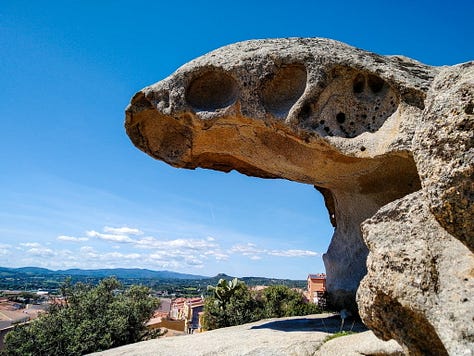
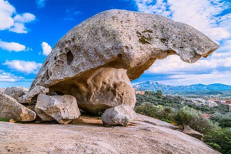
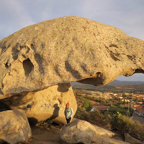
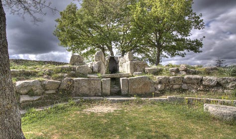
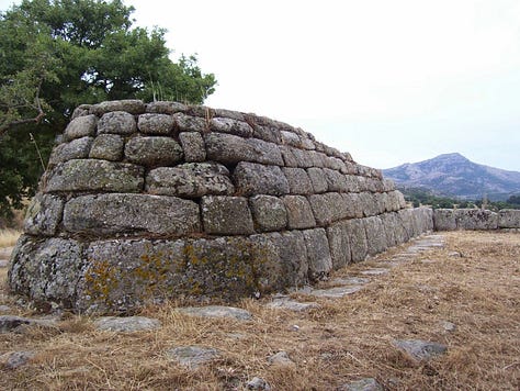
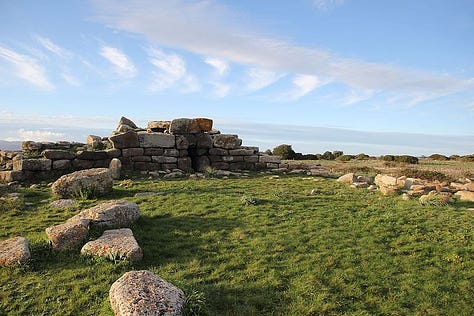


It is suggested that the name had a religious connotation from its use also as the adjective for the ancient Sardinian mythological hero-god Sardus Pater ("Sardinian Father"; a common explanation that the term means "Father of the Sardinians" is incorrect, as that would be "Sardorum Pater"), as well as being the stem of the adjective "sardonic".
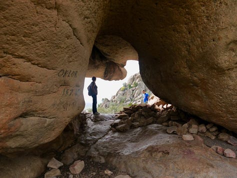
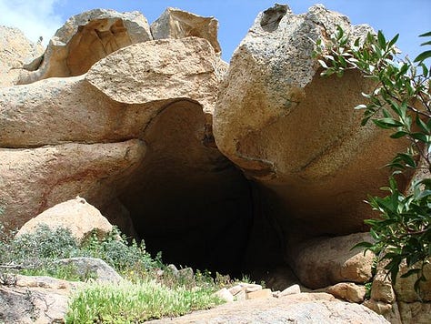

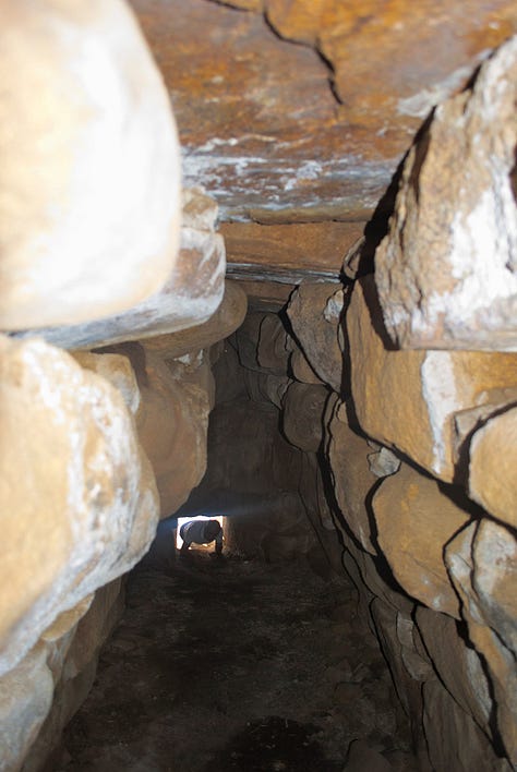

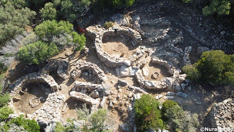
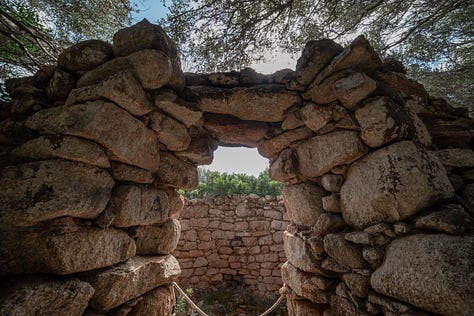
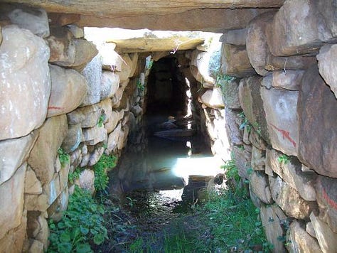
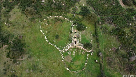
In classical antiquity, Sardinia was called a number of names besides Sardṓ (Σαρδώ) or Sardinia, like Ichnusa (the Latinised form of the Greek Ἰχνοῦσα), Sandaliotis (Σανδαλιῶτις) and Argyrophleps (Αργυρόφλεψ).
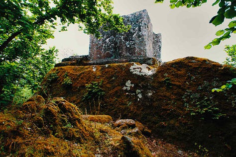
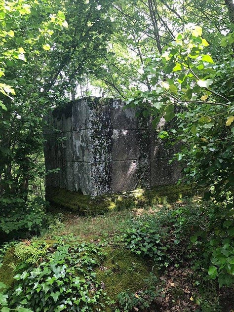
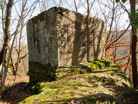
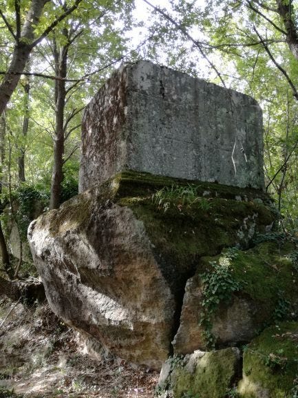
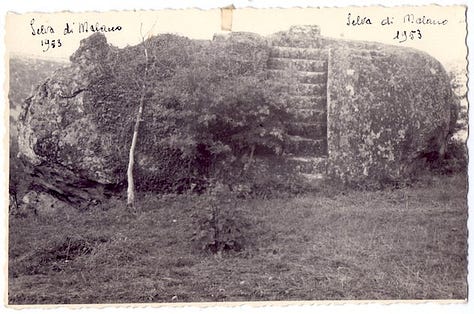
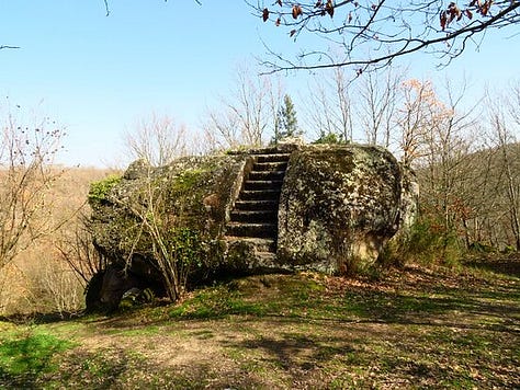
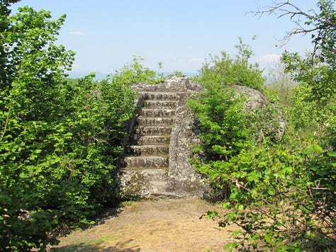
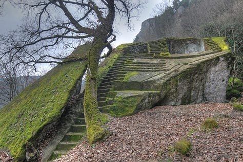
Selva Malano (Etruscan)
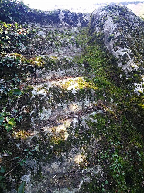
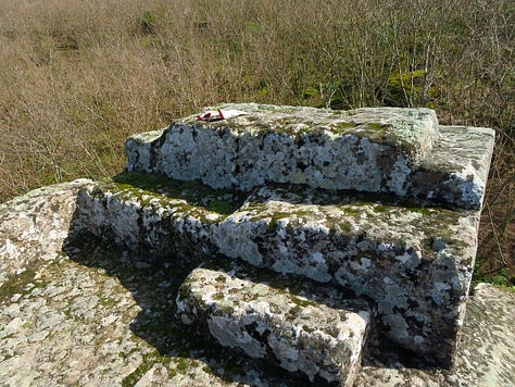
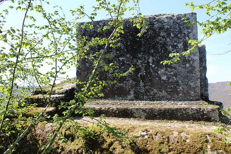
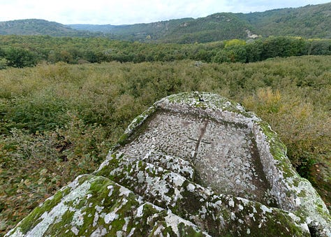
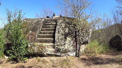
This site has been bastardized by half-assed researchers, including calling it an ancient pyramid, which it is not, so I do not wish to add to that with my own speculation, but rather just bring it to your attention as an area of interest.





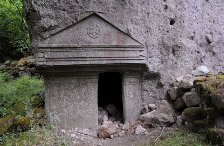
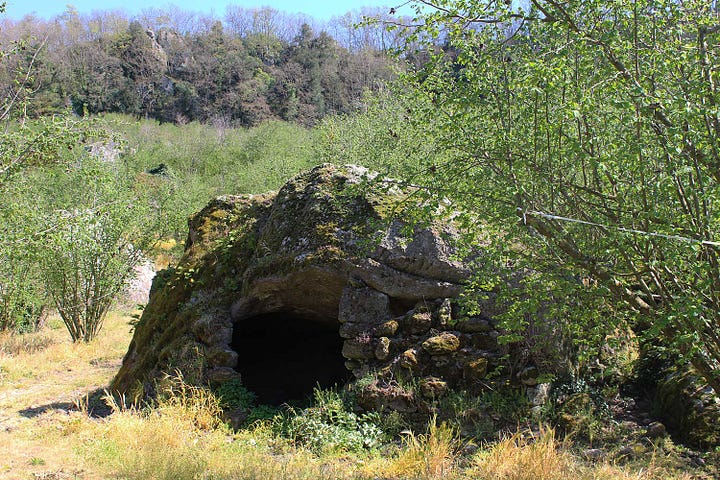
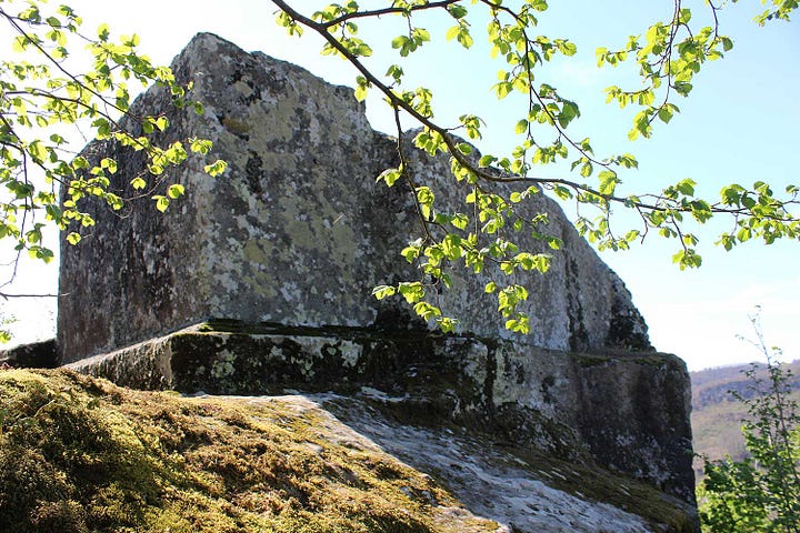
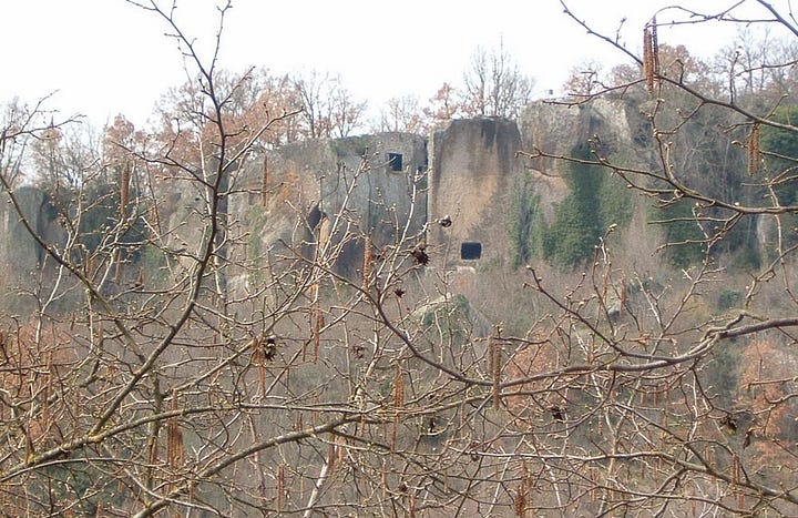
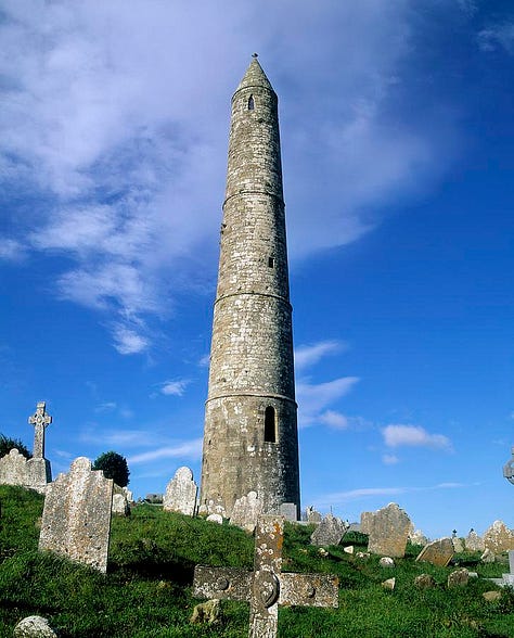
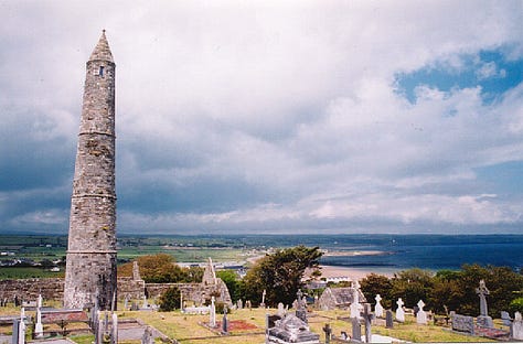
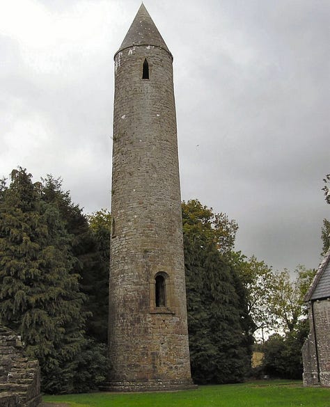
Sepulchral Towers
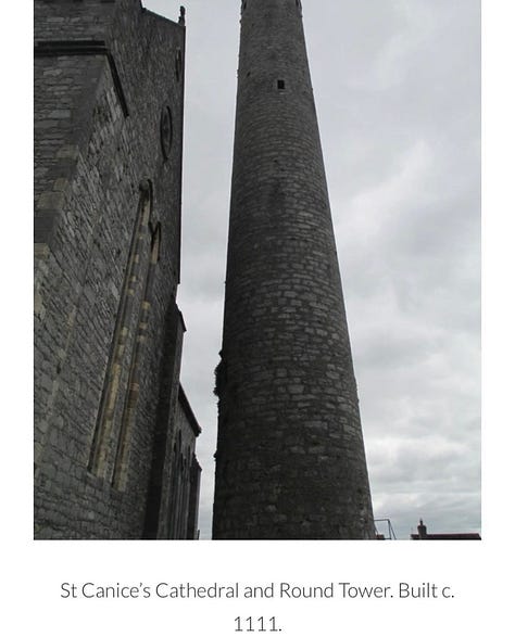
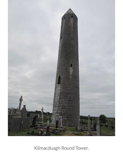
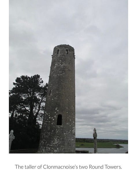
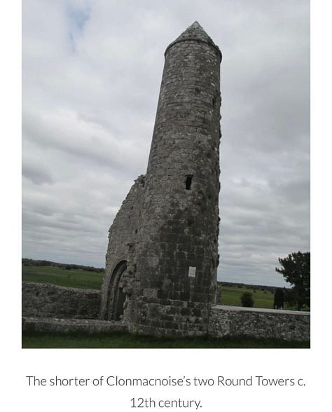
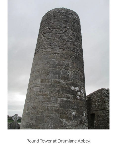
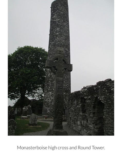
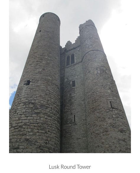
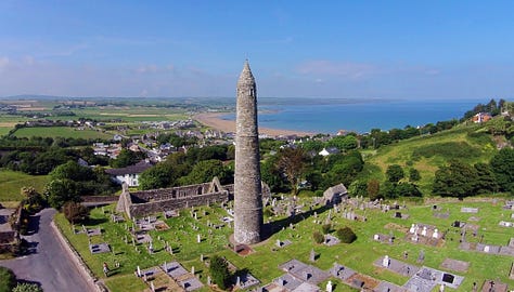
These exist all over Ireland, their appearance unique, but their purpose is not. They are sepulchral in nature and the remains of prominent people were dug up underneath them.




Serri (Nuragic Sanctuary of Santa Vittoria)
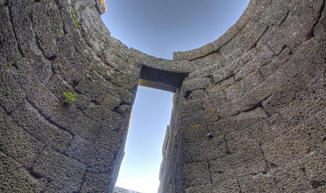
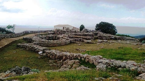
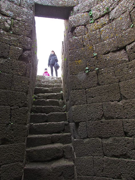
The Nuragic sanctuary of Santa Vittoria is an archaeological site located in the municipality of Serri, Sardinia – Italy. The name refers to the Romanesque style church built over a place of Roman worship which rises at the westernmost tip of the site. The Santa Vittoria site was frequented starting from the first phase of the Nuragic civilization corresponding to Middle Bronze Age (1600-1300 BC). Subsequently, from the late Bronze Age to the early Iron Age (1100-900 / 800 BC), the place became one of the most important expressions of the Nuragic civilization and today it constitutes the most important Nuragic complex so far excavated.
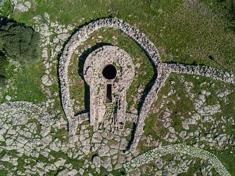

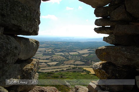

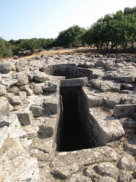
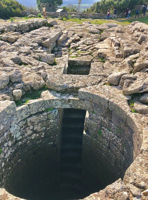

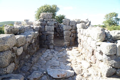
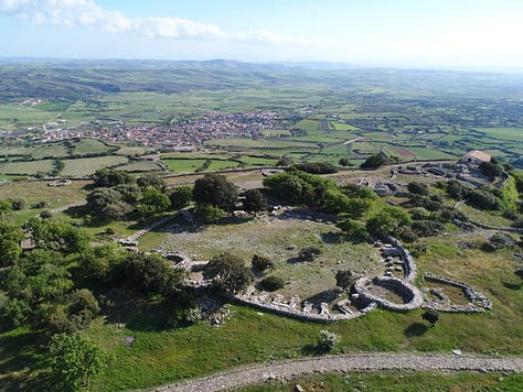
The various excavation campaigns, started in 1909 by Antonio Taramelli, extracted objects such as stylized nuraghes, bronze and stone bull protomes, votive weapons, fragments of lamps and numerous ex-voto mostly in bronze consisting of anthropomorphic and zoomorphic figurines and models of everyday objects as well as other important findings that testify the relationships the Nuragics had with the Etruria, Phoenicia and Cyprus. The discovery of objects and coins of various mints highlight the continuity in use of the site in the subsequent Punic, Roman, Byzantine and medieval periods.
Sese Grande Pantelleria
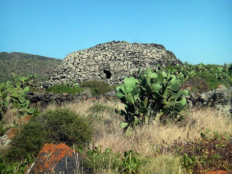
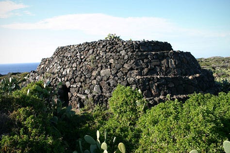
According to Wiki, The sese is a funeral mound megalithic, built in the second millennium BC on the island of Pantelleria from civilization shears.
All known sesi were built in the Cimillia and Mursia districts, around a vast fortified town, in the north-western portion of the island of Pantelleria.
After the first studies of Guido Dalla Rosa (1870) and Francesco Saverio Cavallari (1874), was the archaeologist Paolo Orsi with an expedition between the 1894 and the following year, to demonstrate that the sesi were tombs, although his census and excavations conducted on some monuments did not allow to find any intact burial. In recent years ( 1997-2008 ) the research of Fabrizio Nicoletti and Sebastiano Tusa has made it possible to identify new sesi, two of which have for the first time returned intact funeral depositions.
About one hundred sesi are known on Pantelleria soil. The largest is the so-called Sese Grande or Sese del Re, 5.58 meters high and with a diameter of 20 meters.

Standing Stones
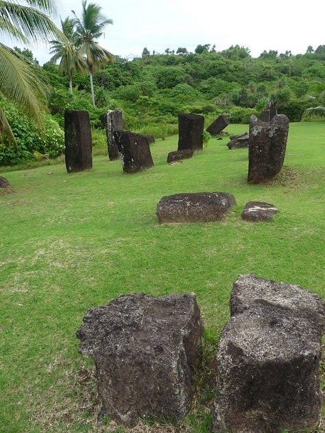
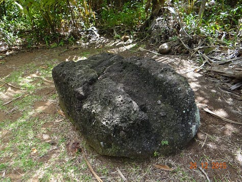
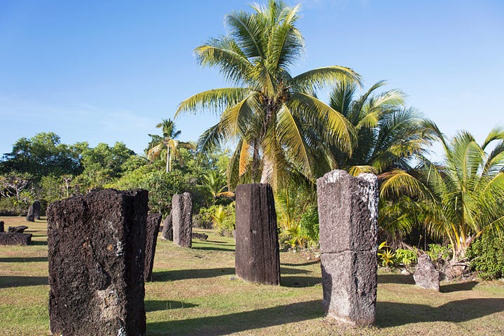
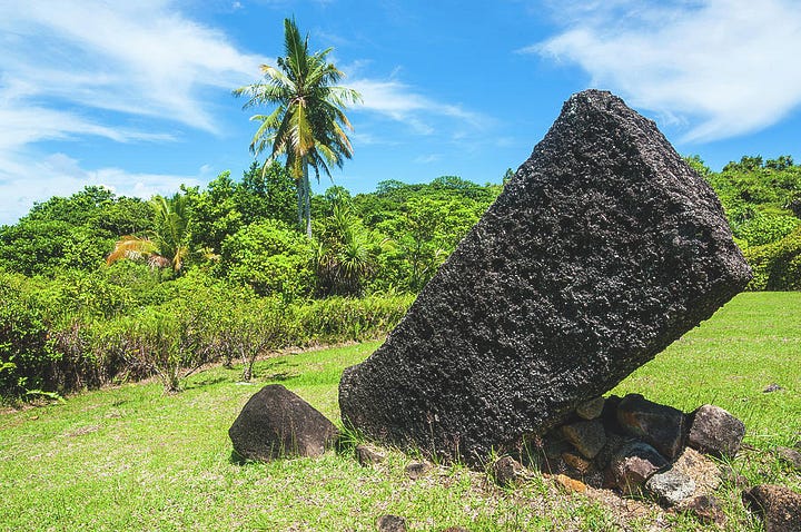
Badrulchau Stone Monoliths (Palau)
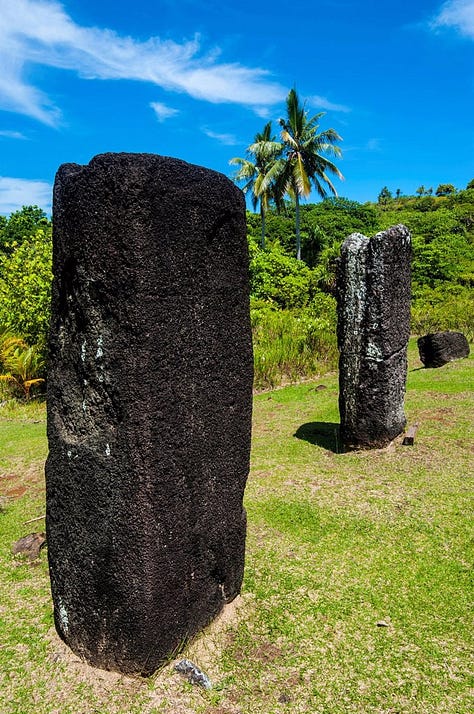
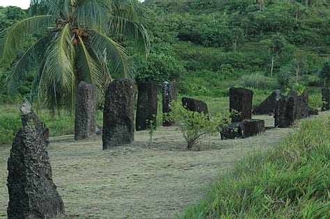
According to Wiki, Ngarchelong is a state in Palau. Ngarchelong is at the northernmost tip of the island of Babeldaob. (Similar to Babylon, with the switch of Tao/Doa instead of the god On. Is this the origin of Taoism?) Only the state of Kayangel is farther north.
Ngarchelong is the site of ancient stone monoliths which are mysterious in origin. Traditional Palaun religion regarded these stone monoliths as sacred prayer ground. There are other stone monoliths located in and around the islands but one will not see as many as there are in Ngarchelong.


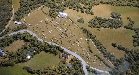
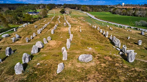
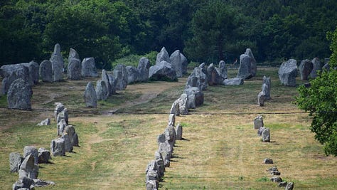
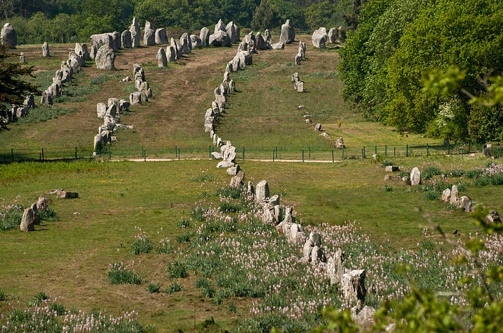
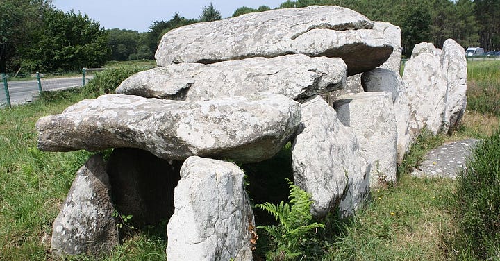
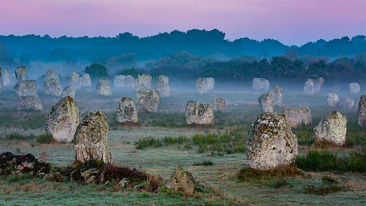
Carnac Stones (France)
More than 3,000 prehistoric standing stones were hewn from local granite and erected by the pre-Celtic people of Brittany and form the largest such collection in the world. Most of the stones are within the Breton municipality of Carnac, but some to the east are within neighboring La Trinité-sur-Mer. The stones were erected at some stage during the Neolithic period, probably around 3300 BC, but some may date to as early as 4500 BC.

Devil's Arrows (Yorkshire, England)
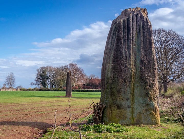
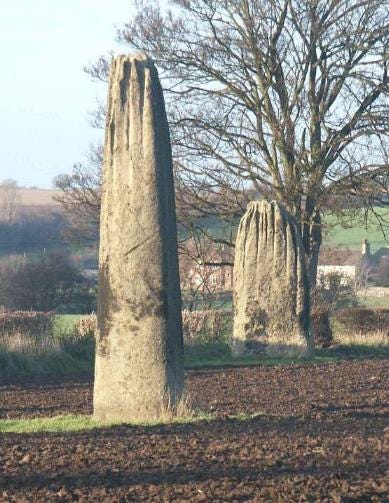
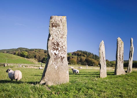
Erected in prehistoric times and distinctively grooved by millennia of rainfall, the tallest stone is 22.5 feet (6.85 m) in height, making this the tallest menhir in the United Kingdom after the 25 feet (7.6 m) tall Rudston Monolith in the East Riding of Yorkshire. The other two stones are 22 feet (6.7 m) and 18 feet (5.5 m) tall respectively, and it is thought that the alignment originally included up to five stones. William Camden mentions four stones in his Britannia, noting that “one was lately pulled downe by some that hoped, though in vaine, to finde treasure.” One was apparently displaced during a failed 'treasure hunt' during the 18th century and later used as the base for a nearby bridge over a river. The stones are composed of millstone grit, the most likely source of which is Plumpton Rocks two miles south of Knaresborough, and about nine miles from where the stones stand today.


Drumtroddan (Scotland)
According to Wiki, the original purpose of the monument is unclear. It has been suggested that it may have been used in observations of the sun or moon. Monuments of this type are found in concentrations in south-west Ireland, south-west Scotland, and the western seaboards of Scotland. The standing stones are part of larger landscape of prehistoric sites which includes the nearby Drumtroddan cup and ring marked rocks and the Big Balcraig cup and ring marked rocks.
Drumtroddan is a Gaelic name meaning 'ridge of the quarrel' from Gaelic druim 'ridge' and trodan 'quarrel, contention'.

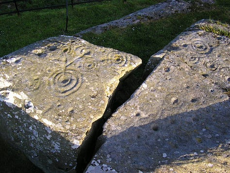


Kilmartin Glen (Scotland)
According to Wiki, Kilmartin Glen is an area in Argyll north of Knapdale. It has the most important concentration of Neolithic and Bronze Age remains in mainland Scotland.
There are more than 800 ancient monuments within a six-mile (ten-kilometre) radius of the village, with 150 monuments being prehistoric. Monuments include standing stones, a henge monument, numerous cists, and a "linear cemetery" comprising five burial cairns. Several of these, as well as many natural rocks, are decorated with cup and ring marks.


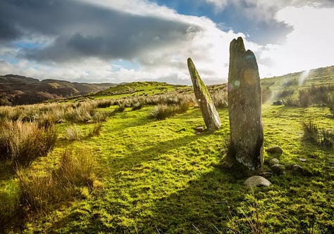

Kilmartin Glen has a remarkable concentration of some of the most impressive cup and ring decorated rock surfaces in Scotland. The purpose, and even the precise date, of cup and ring marks is uncertain. They are found on natural rock surfaces at Achnabreck, Cairnbaan, Ballygowan, and Baluachraig near Kilmichael Glassary. In 2021, rock art depicting animals was discovered inside Dunchraigaig Cairn, estimated to date to between 2000 and 3000 BC, the earliest found in Scotland.
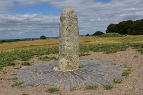
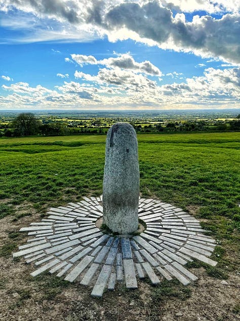
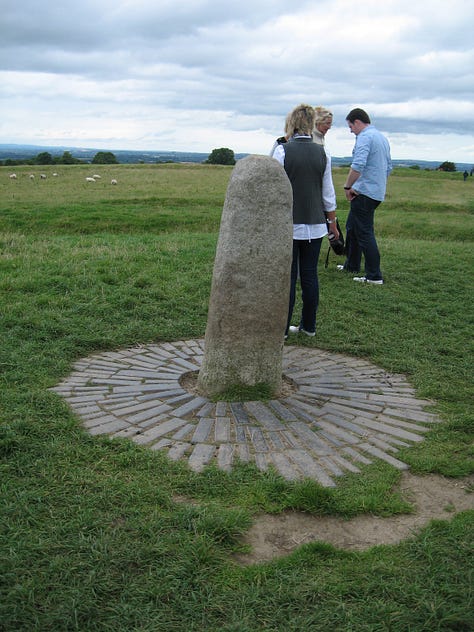
Lia Fail (Ireland)
According to Wiki, The Fál or Lia Fáil; Stone of Fál) is a stone at the Inauguration Mound on the Hill of Tara in County Meath, Ireland, which served as the coronation stone for the King of Tara and hence High King of Ireland. It is also known as the Stone of Destiny or Speaking Stone. According to legend, all of the kings of Ireland were crowned on the stone up to Muirchertach mac Ercae, c. 500 CE.
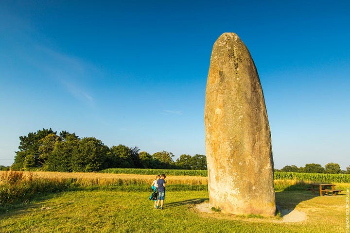
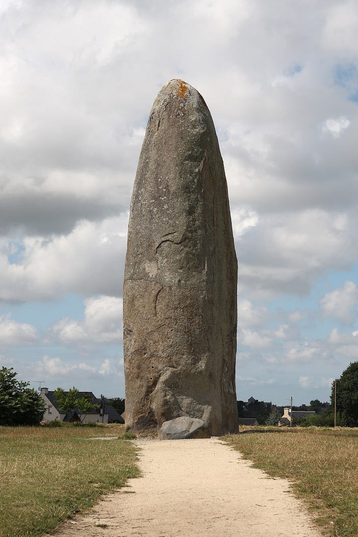
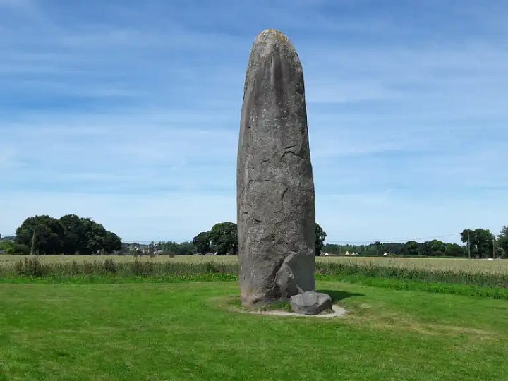
Menhir de Champ-Dolent (France)
Nothing satisfactory is known about this. According to Wiki, it is not precisely dated, but recent scholarship suggests that Brittany's menhirs were erected c. 5000–4000 BC. Yet it is one of the most remarkable things I’ve ever seen in this field and should be an area of interest.

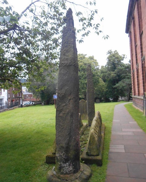
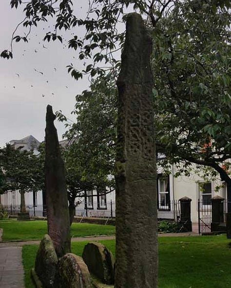
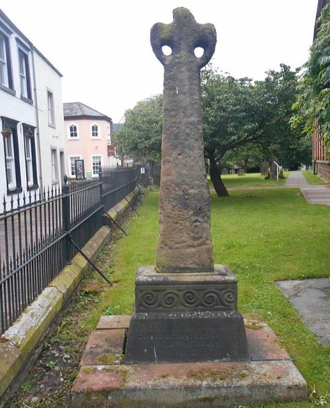
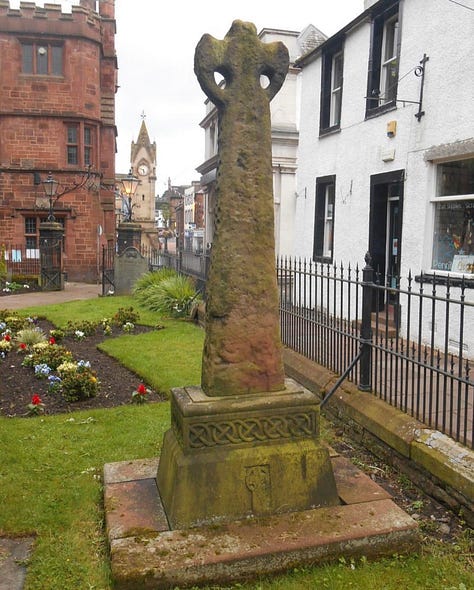
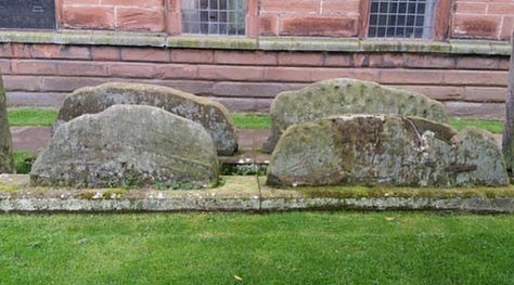
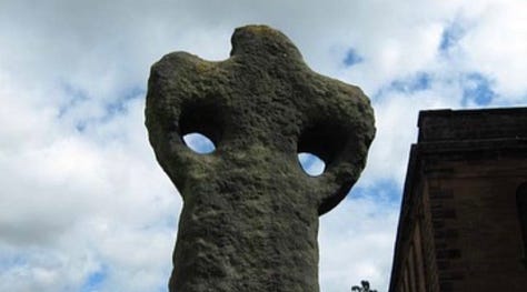
Pillars at Penrith Churchyard
According to Wiki, the Giant's Grave dates from the 10th century. It consists of two Anglo-Saxon cross shafts and four hogbacks, which have been in their present arrangement since at least 1664–65.





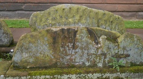
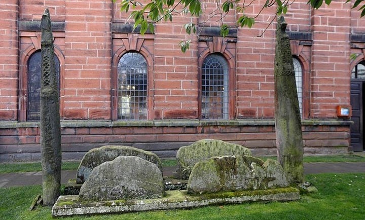
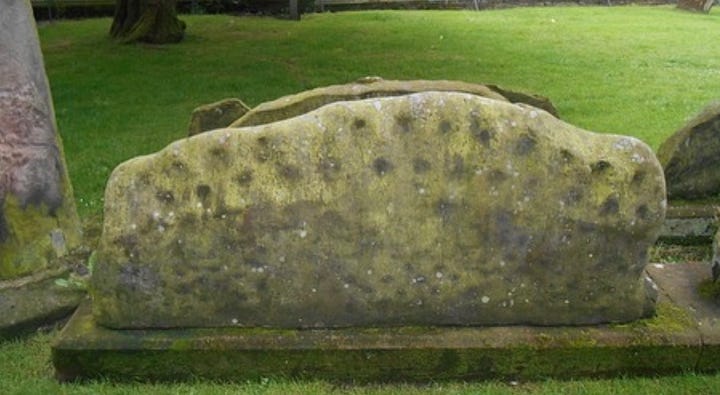
Rudston (Boroughbridge, England)
According to Wiki, the Rudston Monolith stands in the parish churchyard. At over 25 feet (7.5 metres) tall, it is the tallest standing stone in England, and gave the village its name; it is Grade I listed.
Southside Mount round barrow is situated to the south west of the village close to Woldgate reservoir.

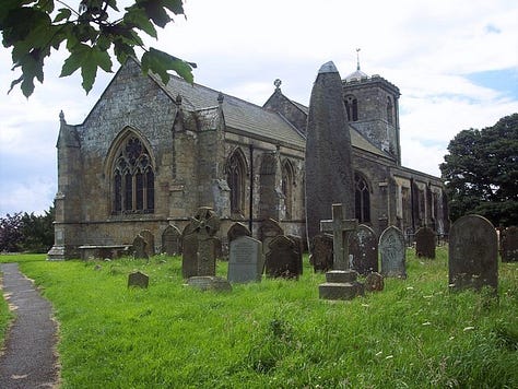
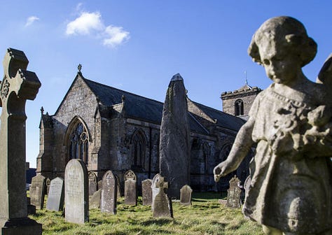
The place-name 'Rudston' is first attested in the Domesday Book of 1086, and means 'rood' or 'cross' stone, referring to the monolith. However, the name 'rud' derives from Old Norse ruð, meaning a clearing or pasture. So the place name could be stone in the clearing, Ruðstane.
Rudston Roman villa, noted for its mosaics, was first excavated in 1839. It was subsequently re-excavated in the 1930s, 1960s and 1970s. The mosaics are now in the Hull and East Riding Museum.
Stone Circles
Abury/Avebury (England)
According to Wiki, Avebury (/ˈeɪvbəri/) is a Neolithic henge monument containing three stone circles, around the village of Avebury in Wiltshire, in southwest England. One of the best known prehistoric sites in Britain, it contains the largest megalithic stone circle in the world.
Constructed over several hundred years in the third millennium BC, during the Neolithic, or New Stone Age, the monument comprises a large henge (a bank and a ditch) with a large outer stone circle and two separate smaller stone circles situated inside the centre of the monument.
Evidence of activity in the region before the 4th millennium BC is limited, suggesting that there was little human occupation.
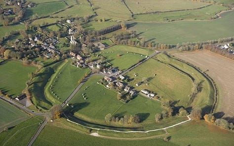
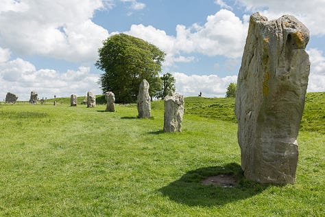
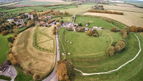
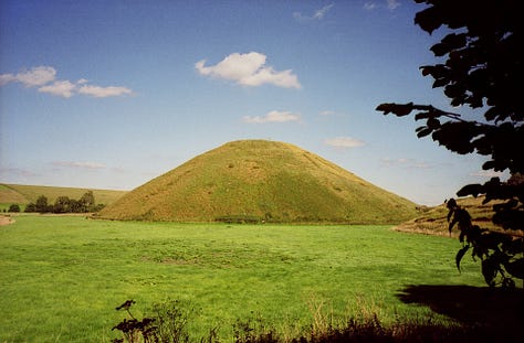

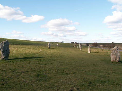
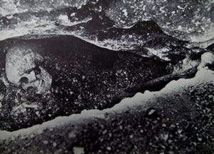
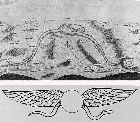
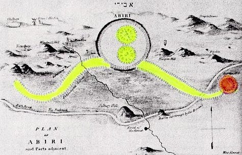
As one can see, this site is almost exclusively Phoenician and/or Egyptian. Were that date of 4000 BC to be accurate, it’d establish them peopling Britain that long ago.
Bulgarian Stonehenge (Staro Zhelezare)


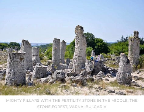
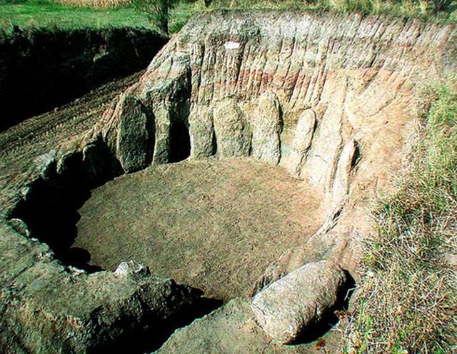
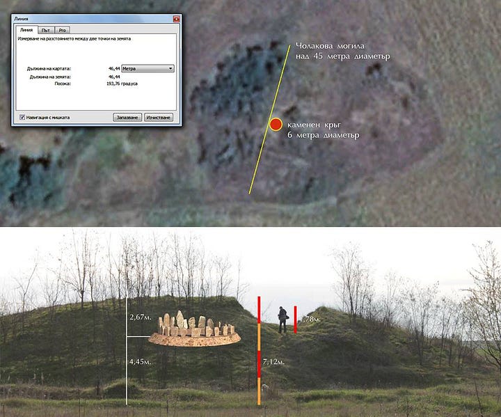
Callanish Stones (Scotland)
According to Wiki, they were erected in the late Neolithic era, and were a focus for ritual activity during the Bronze Age. They are near the village of Callanish (Gaelic: Calanais) on the west coast of Lewis in the Outer Hebrides, Scotland.
The first traces of human activity are indicated by a broad ditch (no longer visible above ground) which appears to have belonged to some structure or enclosure. This may have been ritual, but could instead have been domestic. In the centuries around 3000 BC, however, the site was turned over to agriculture, which obliterated most of the earlier traces. After this, the site was allowed to grass over for a time.

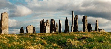

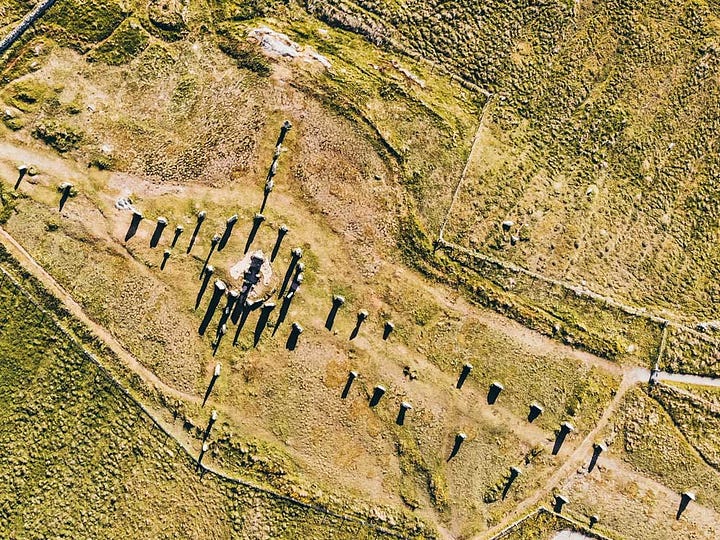
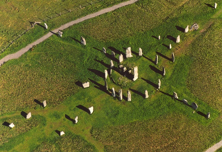


The stone circle was set up between 2900 and 2600 BC. It is not clear whether the stone alignments were constructed at the same time as the circle, or later. Some time after the erection of the stones, a small chambered tomb was inserted into the eastern part of the stone circle. The many pottery fragments found indicate that the tomb was used for several centuries. These pottery fragments included not only the local Hebridean pots, but numerous sherds of beaker vessels (dating to around 2000–1700 BC) and shards of grooved ware.
Around 1500–1000 BC the complex fell out of use and was despoiled by the later Bronze Age farmers. Fragments of pots appear to have been cast out of the chamber. This may have been just ordinary agriculture, but it may conceivably have been ritual cleansing. There appears to have been a later rebuilding of the tomb, but this may have been for domestic use as there is no evidence for any later ritual use of the monument. Excavations in 1999–2000, to the south of the stones, found fragments of a prehistoric field system buried beneath blanket peat, as well as stone structures, including buildings, walls, clearance cairns and cobbled surfaces. The analyses found that these features were the result of prehistoric farming activity from the Late Bronze Age/Early Iron Age indicating the whole area was used for farming at that time. Between 1000 BC and 500 BC the stones were covered by a thick layer of turf. It is estimated that the place was abandoned around 800 BC. Only in 1857 was the overlying 1.5 metres of peat removed.
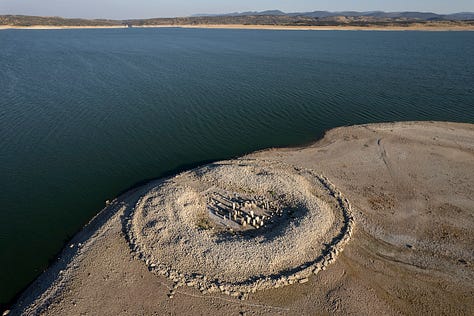
Dolmen of Guadalperal (Spain)
According to Wiki, it could have been a solar temple, and also been used as a burial enclave. Roman remains found there – a coin, ceramic fragments, and a grinding stone – indicate that at that time it was safely preserved from looting. Eleven axes, ceramics, flint knives, and a copper punch were found in a nearby dump. A settlement was also found, dating to the time of construction, which presumably housed the builders. Obermaier discovered houses, charcoal and ash stains, pottery, mills, and stones to sharpen axes.
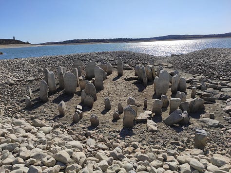
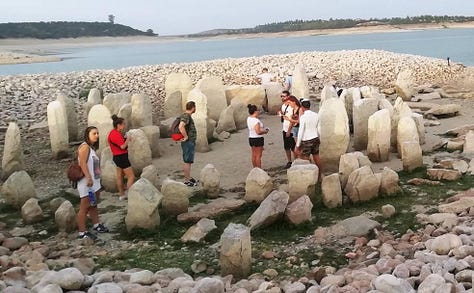
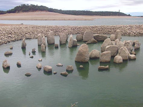
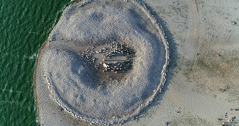
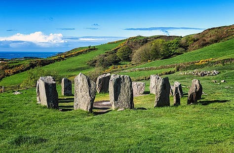
Drombeg Cromlech (Ireland)
According to Wiki, it was excavated in 1958, when the cremated remains of an adolescent was found in a pot in the circle's center. Radiocarbon dating of samples taken from the site suggest that it was active c. 1100–800 BC. An inverted pot, found in the centre of the circle, contained the cremated remains of a young adolescent wrapped with thick cloth. The stone circle originally consisted of seventeen closely spaced stones of which 13 survive. The stones are made from local sandstone.


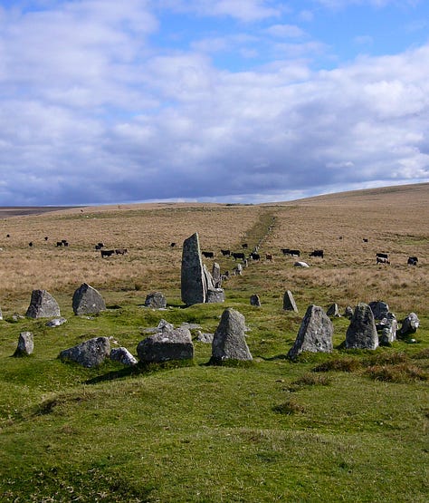
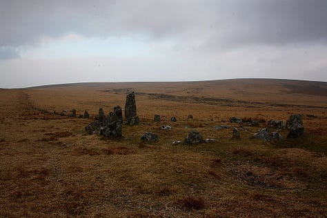
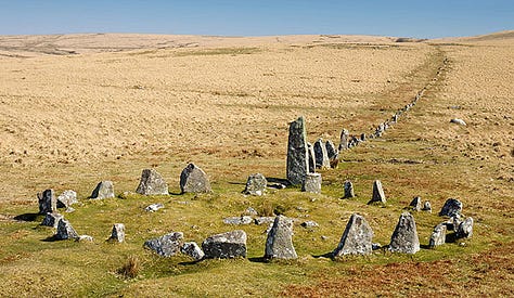
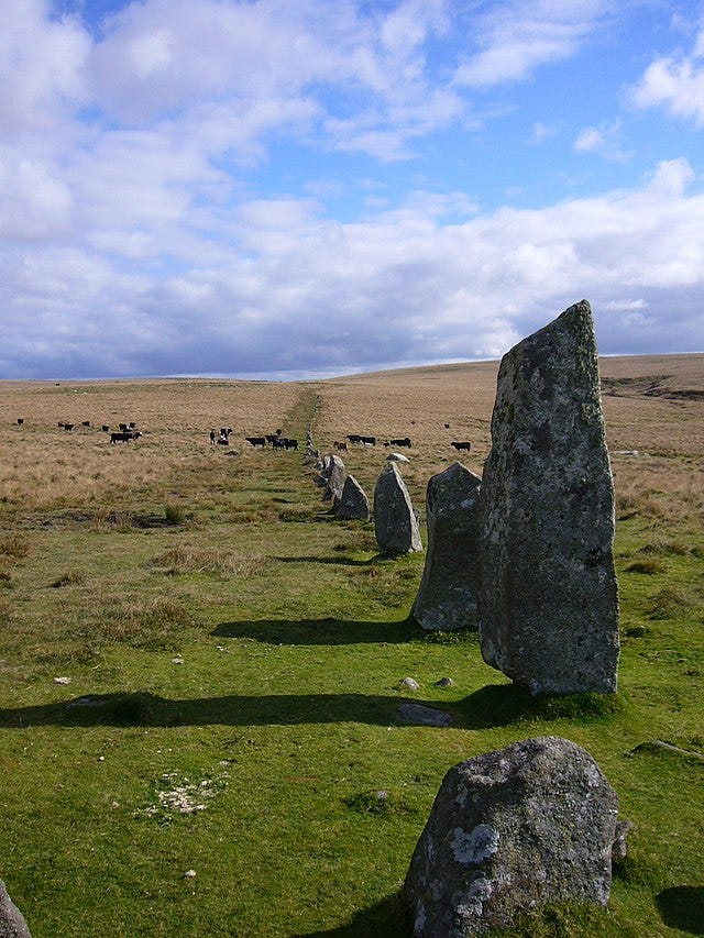
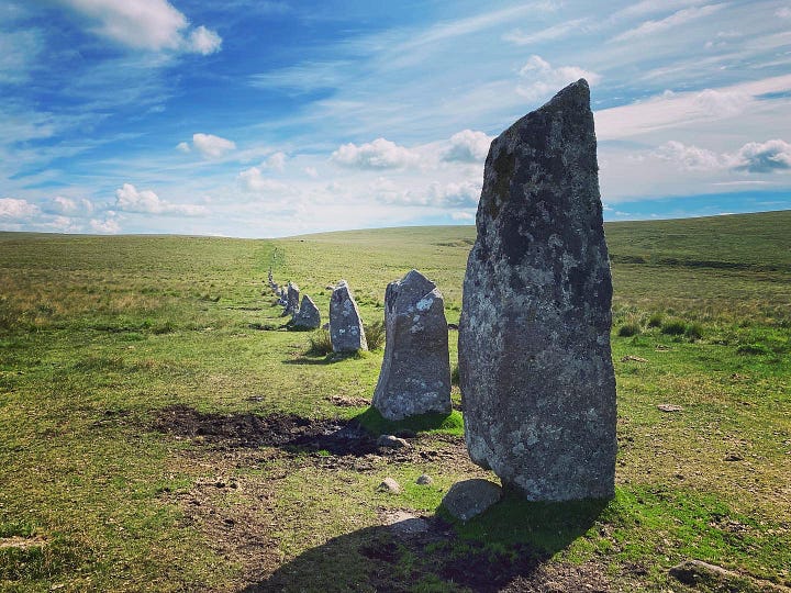
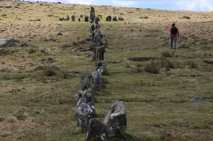
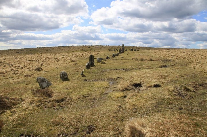
Hingston Hill Circle and Row, aka Down Tor (England)
Not much is known about this amazing prehistoric site, but it has elements of diffusion that will enlighten the world if figured out.
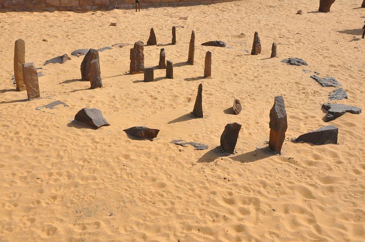
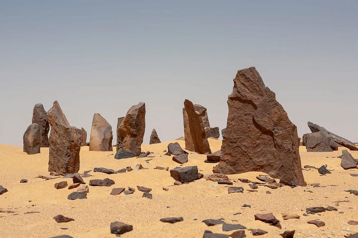
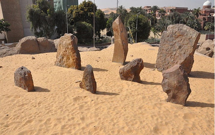
Nabta Playa (700 Miles South of Egypt)
According to Wiki, in the 5th millennium BC these peoples fashioned what may be among the world's earliest known archeoastronomical devices (roughly contemporary to the Goseck circle in Germany and the Mnajdra megalithic temple complex in Malta). These include alignments of stones that may have indicated the rising of certain stars and a calendar circle that indicates the approximate direction of summer solstice sunrise. Calendar circle may be a misnomer as the spaces between the pairs of stones in the gates are a bit too wide, and the distances between the gates are too short for accurate calendar measurements. An inventory of Egyptian archaeoastronomical sites for the UNESCO World Heritage Convention evaluated Nabta Playa as having hypothetical solar and stellar alignments.
In other words, not much is known about the site, so if authentic, must remain an area of interest.

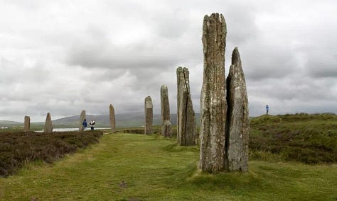
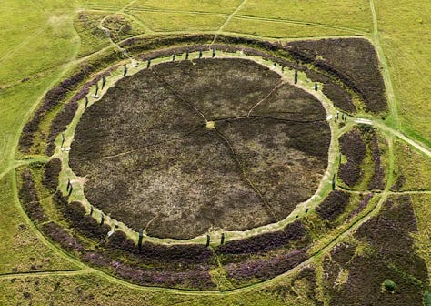
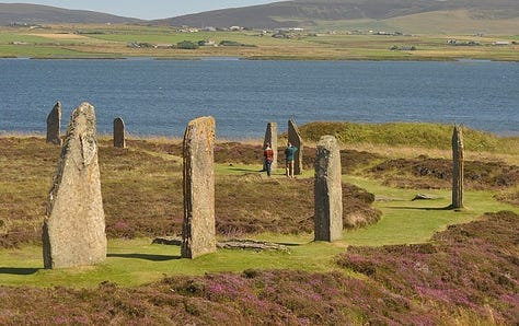
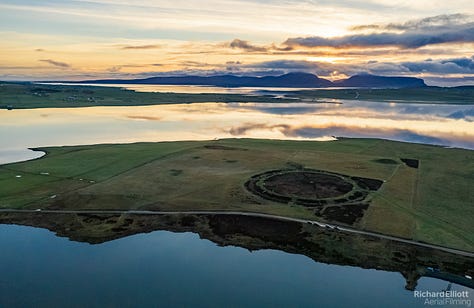
Ring of Brodgar (Scotland)
According to Wiki, the site resisted attempts at scientific dating and the monument's age remains uncertain. It is generally thought to have been erected between 2500 BC and 2000 BC, and was, therefore, the last of the great Neolithic monuments built on the Ness.
Wow. In other words, solve this puzzle and make a name for yourself, researchers. It looks a lot like Abury.





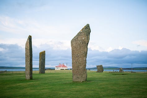
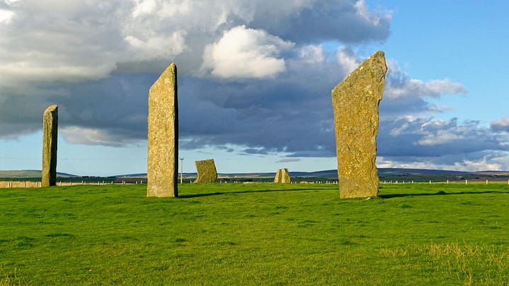
Stones of Stenness (Orkney, Scotland)
According to Wiki, the Standing Stones of Stenness is a Neolithic monument. The pottery links the monument to Skara Brae and Maeshowe. Based on radiocarbon dating, it is thought that work on the site had begun by 3100 BC.



Temples
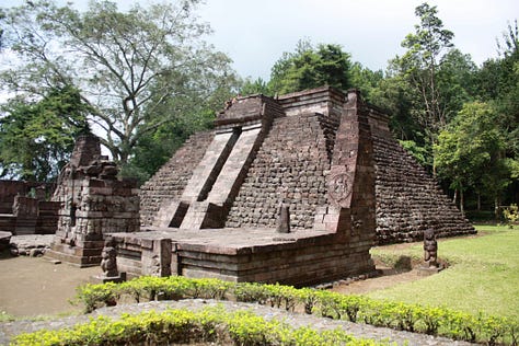
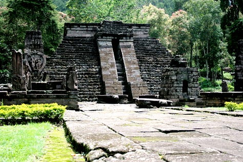
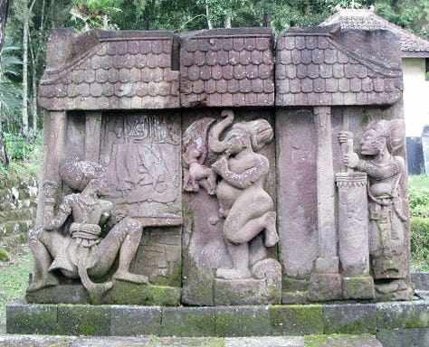
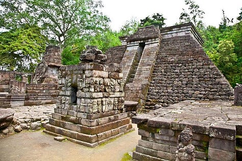
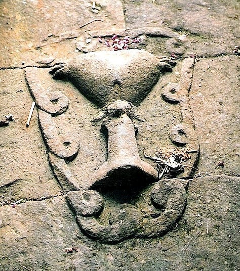
Candi Sukuh (Java)
According to Wiki, it is a 15th-century Javanese-Hindu temple (candi) that is located in Berjo, Ngargoyoso district, Karanganyar Regency, Central Java, Indonesia on the western slope of Mount Lawu (elevation 910 metres (2,990 ft)). This temple has a height of 87 meters.
I think it is an example of cultural diffusion between Java and Mexico. I have yet to find a person that I send pictures of the temple to, without context, asking them where it is located, reply with anything other than Mexico.

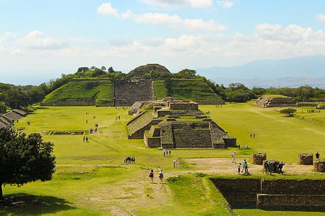
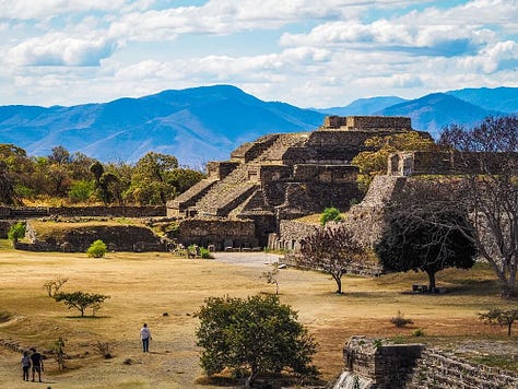
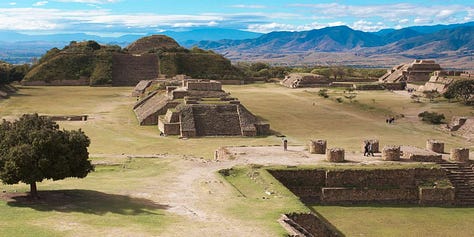
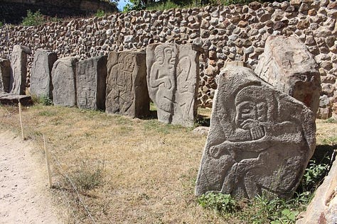
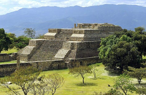
Monte Alban (Mexico)
According to Wiki, besides being one of the earliest cities of Mesoamerica, Monte Albán was important for nearly one thousand years as the pre-eminent Zapotec socio-political and economic center. Founded toward the end of the Middle Formative period at around 500 BC, by the Terminal Formative (c. 100 BC – AD 200) Monte Albán had become the capital of a large-scale expansionist polity that dominated much of the Oaxacan highlands and interacted with other Mesoamerican regional states, such as Teotihuacan to the north (Paddock 1983; Marcus 1983). The city lost its political pre-eminence by the end of the Late Classic (c. AD 500–750), and soon thereafter was largely abandoned.
The name Alba makes the site of particular interest to me, the root being found in Phoenician language and locations in Italy, as well as Albania. The native accounts of these temples being built by European looking men, which I used to think was a white-washing of history, is also of particular interest since the Americans had no hard tools, no use of beasts of burden nor pulley-systems, and nothing to indicate they were the originators of these structures.

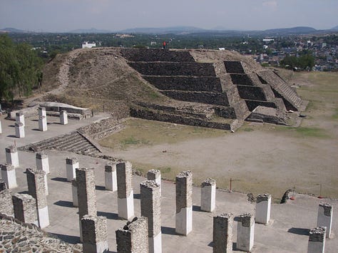
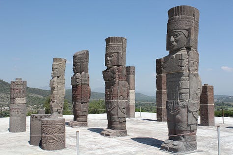
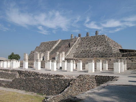
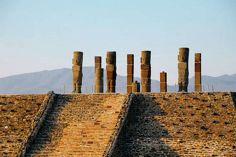
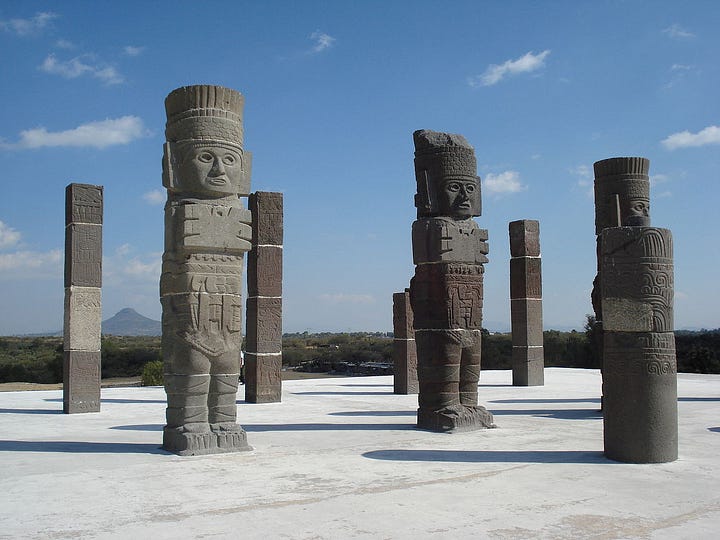
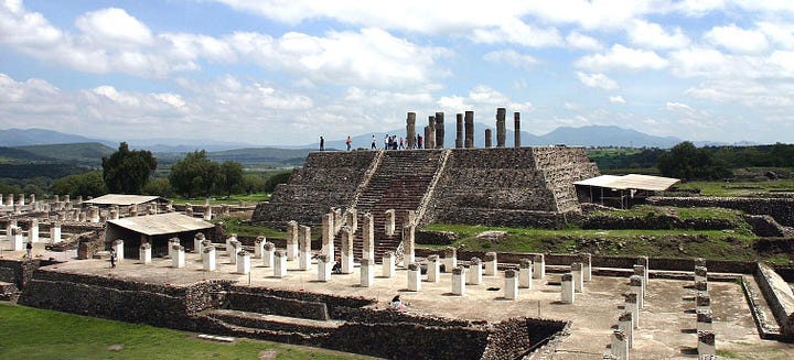
Tula Atlantes (Mexico)
According to Wiki, Tula has long been considered the capital for the Toltec people. At Tula one can find the Temple of Tlahuizcalpantecuhtli ('House of the Morning Star' or 'The Temple of the Lord in the Dawn'), where there are four Atlantean figures standing over 4.6 metres (15 ft) tall. The figures here are depicted as wearing "stylized butterfly breastplates, sun-shaped shields on their backs, feathered headdresses and carry spear throwers and a supply of spears".
The exact dates for when Atlantean figures in Tula were carved is unknown. However, rough estimates can be made by dating the sites. The construction of the Toltec empire has been dated to approximately A.D. 750. This dates mark the earliest time that the figures could have been carved.


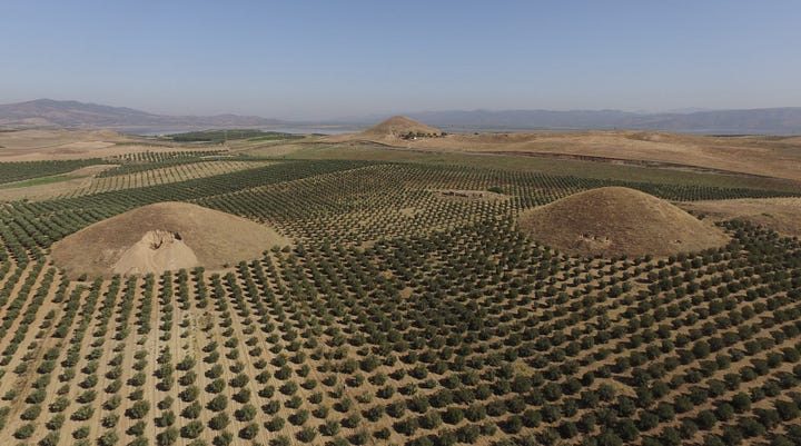
Tomb King Alyattes/Bin Tepe
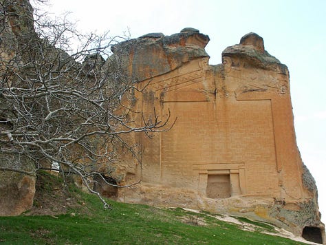
According to Wiki, the earliest of the Bin Tepe tumuli date from around 600 BC, seemingly adapted from Phrygian royal burials at Gordion. The style remained in use after the fall of the Lydian Empire, with many of the datable examples at Bin Tepe having been constructed during the Persian period.
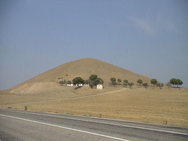


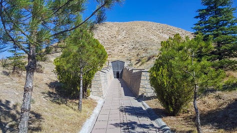
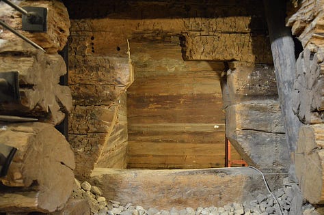
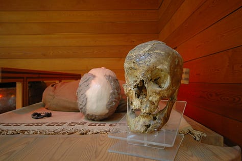
Tomb of Midas In Gordion
According to Wiki, In 1957, Rodney Young and a team from the University of Pennsylvania opened a chamber tomb at the heart of the Great Tumulus (in Greek, Μεγάλη Τούμπα)—53 metres in height, about 300 metres in diameter—on the site of ancient Gordion (modern Yassıhüyük, Turkey), where there are more than 100 tumuli of different sizes and from different periods. They discovered a royal burial, its timbers dated as cut to about 740 BC complete with remains of the funeral feast and "the best collection of Iron Age drinking vessels ever uncovered". This inner chamber was rather large: 5.15 metres by 6.2 metres in breadth and 3.25 metres high. On the remains of a wooden coffin in the northwest corner of the tomb lay a skeleton of a man 1.59 metres in height and about 60 years old. In the tomb were found an ornate inlaid table, two inlaid serving stands, and eight other tables, as well as bronze and pottery vessels and bronze fibulae. Although no identifying texts were originally associated with the site, it was called Tumulus MM (for "Midas Mound") by the excavator. As this funerary monument was erected before the traditional date given for the death of King Midas in the early 7th century BC, it is now generally thought to have covered the burial of his father.
While I don’t agree with a mythological character being buried here, the date may be significant to its creation.

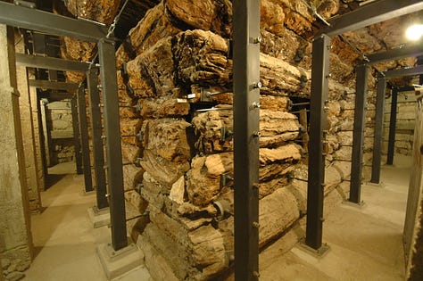
Tombs of Amrith, Phoenicia
According to Wiki, Amrit (Arabic: عمريت), the classical Marathus (Greek: Μάραθος, Marathos), was a Phoenician port located near present-day Tartus in Syria. Founded in the third millennium BC, Marat (Phoenician: 𐤌𐤓𐤕, mrt) was the northernmost important city of ancient Phoenicia and a rival of nearby Arwad. During the 2nd century BC, Amrit was defeated and its site largely abandoned, leaving its ruins well preserved and without extensive remodeling by later generations.


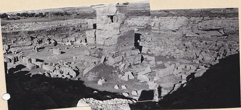
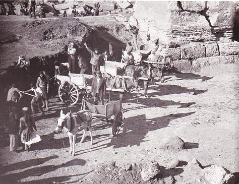


Ceramic ware finds at Amrit indicated the site had been inhabited as early as the third millennium BC. Middle and Late Bronze Age "silo tombs" were also excavated, with contents ranging from weapons to original human remains. Excavations at the necropolis south of the town yielded several tomb structures. The funeral art found in some tombs with pyramidal-or cube-shaped towers, is considered some of the most notable grave-monuments of the Phoenician world. Excavations also uncovered the town's ancient harbor, and a U-shaped stadium that dates back to the 4th and 3rd centuries BC and measures around 230 m (750 ft) in length.
Victory Towers/Columns
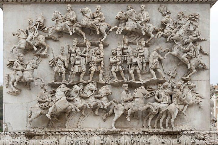
Column of Antoninus Pius (161 AD)
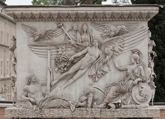


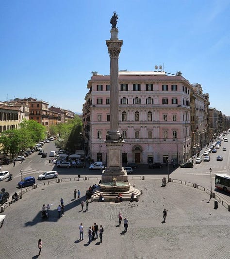
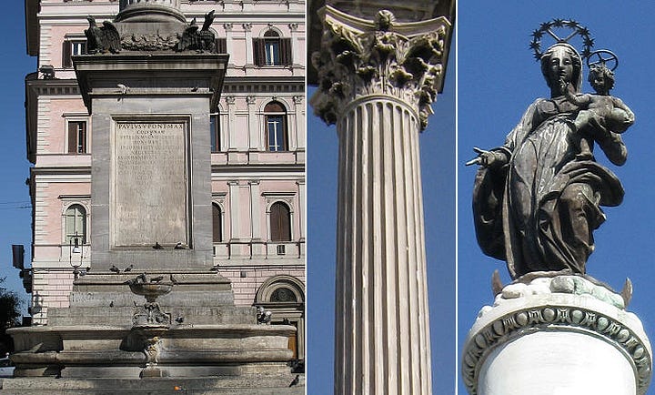
Santa Maria Maggiore


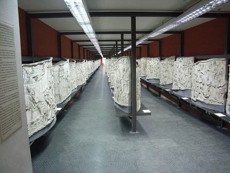
Trajan's Column 113 AD


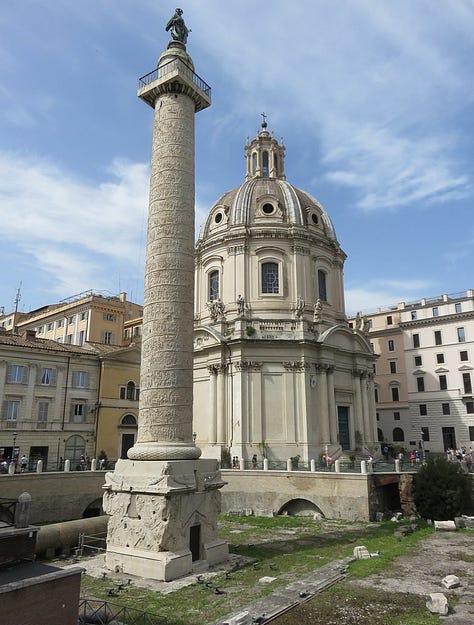
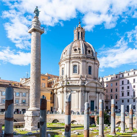
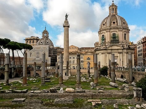
Vijay Stambha (Rajasthan)
According to Wiki, the Vijaya Stambha is an imposing victory monument located within Chittor Fort in Chittorgarh, Rajasthan, India. The tower was constructed by the Hindu Rajput king Rana Kumbha of Mewar in 1448 to commemorate his victory over the army of Malwa led by Mahmud Khalji in the Battle of Sarangpur. The tower is dedicated to Hindu God Vishnu.


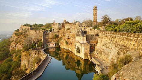
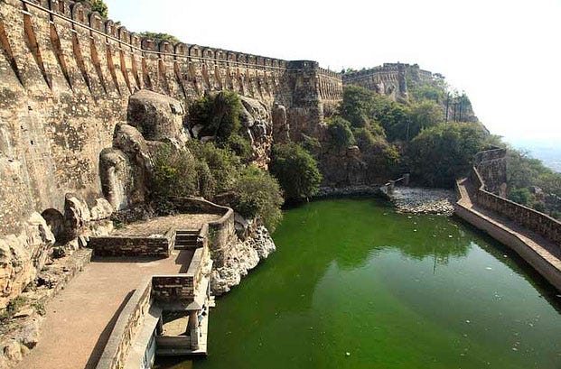

Vitrified Forts
Miscellaneous
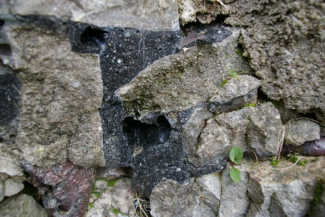
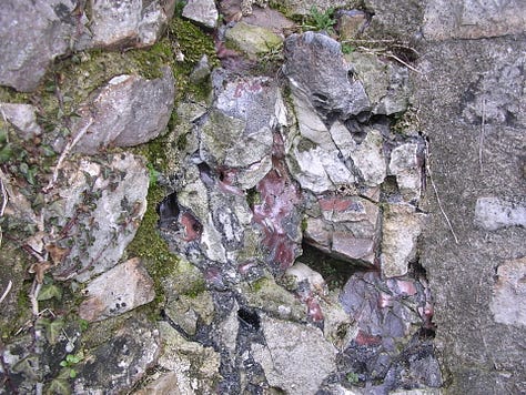

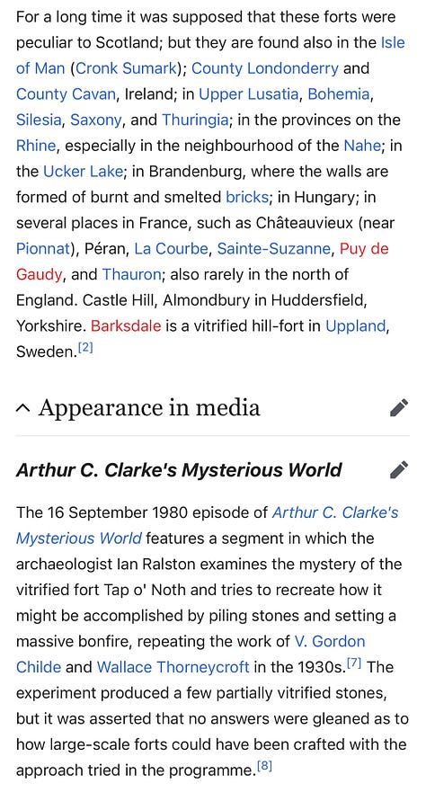


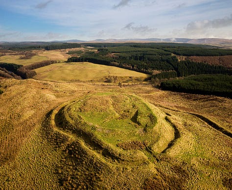
Castle O'er (Scotland)
Not much is known about this site. It may turn up something useful in uncovering the ancient universal empire that has left vestiges everywhere.


If this cultural diffusion intrigued you, dive into The Holy Sailors!
I hope you enjoyed this resource and make sure you share it with your network if you did. When more friends use your referral link to subscribe (free or paid), you’ll receive special benefits.
Get a 1 month comp for 3 referrals
Get a 3 month comp for 5 referrals
Get a 6 month comp for 25 referrals


